

Transformative cycling projects in Waterloo need your support
The Region sits on the cusp of transformative change when it comes to cycling infrastructure. At Tuesday’s Planning and Works Committee meeting, regional councillors will be asked to approve two reports regarding all-ages-and-abilities cycling infrastructure around Uptown and the universities. Your voice is essential in ensuring councillors vote to deliver on these projects.
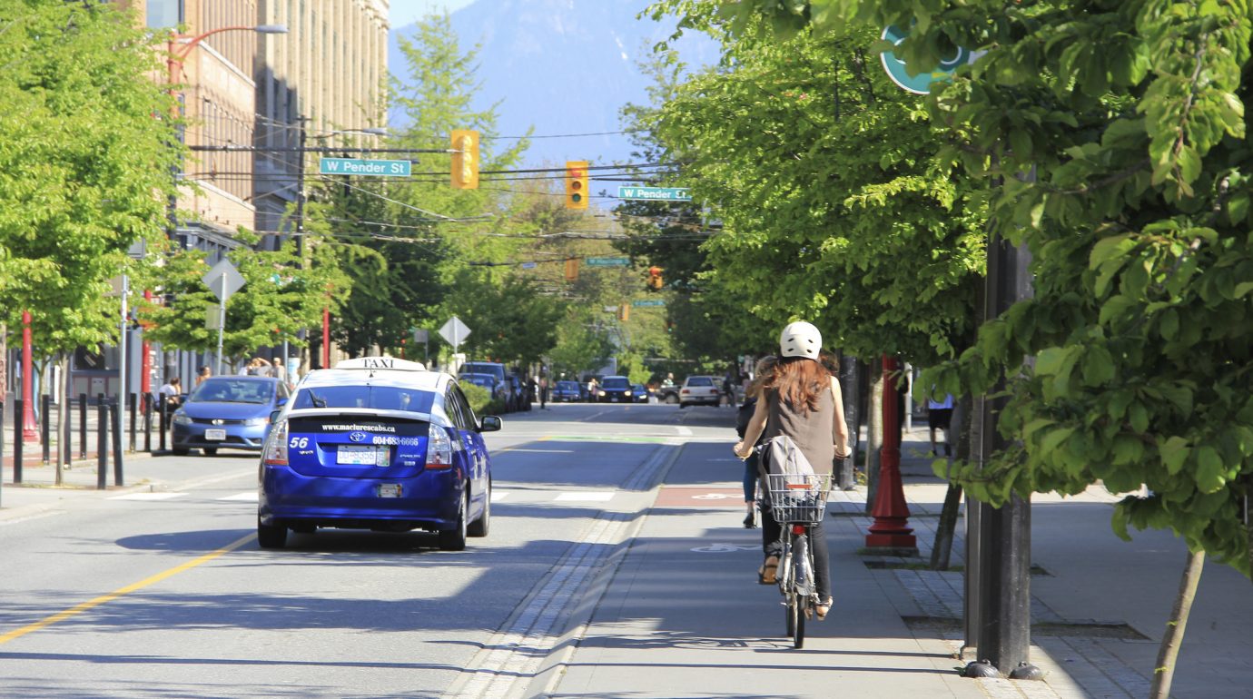
The Uptown King Street bike lanes, which TriTAG played a key role in promoting, have in their implementation received a fair amount of criticism. Justifiably so. The mountable roll-curbs have allowed easy access to illegally parked or stopped vehicles, and enforcement efforts by the City of Waterloo have been pitiful.
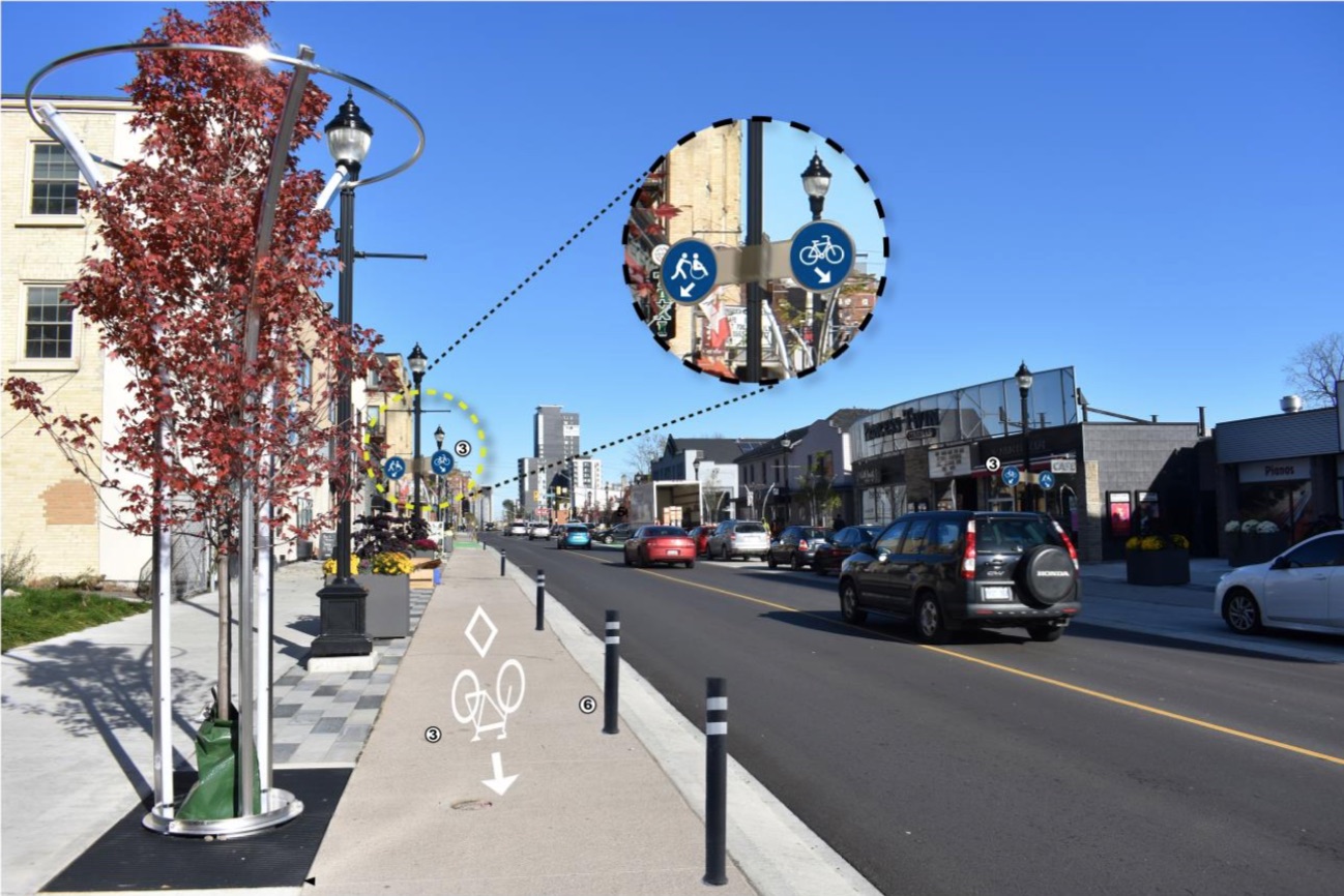
Proposed fixes to the Uptown bike lanes include flex bollards and better signage.
The good news is that staff have listened to public feedback and are now recommending flex bollards for subsequent phases of the streetscape project, as well as retrofitting the southbound bike lane and frequent encroachment points on the northbound lane with bollards as well. Better signage to encourage pedestrians to avoid meandering into the lanes is also proposed.
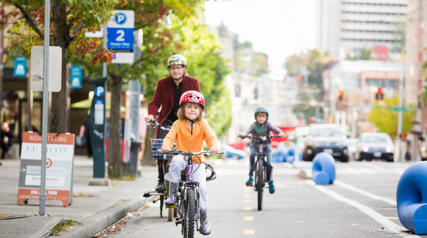
The long-awaited protected bike lane pilot project is also on Tuesday’s agenda. Modelled after cycling network pilots in Calgary and Edmonton, which saw huge surges in cycling trips after they were built, the pilot would focus on both protected infrastructure and rapidly forming a cohesive network of routes in a high-demand area. Existing road space on King Street, Erb Street, University Ave, and Columbia Street around Uptown and Northdale would be reallocated to provide bike lanes with buffers and flex bollards. Precast curbs would also be used on King, Erb, and University.
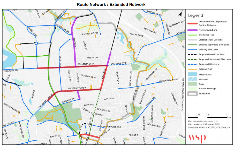
Proposed network and potential extensions
What’s remarkable about the pilot is the degree to which Regional transportation staff are willing to consider narrowing or removing motorized vehicle lanes to facilitate the project. Until now, challenges to the Region’s road dimensions dogmatism (unless it’s to reduce the width of a bike lane) have been virtually non-existent. However, narrower travel lanes lead to safer speeds and shorter crossing distances for pedestrians, which reduces the number and severity of collisions with vulnerable road users. Staff are also willing to accept some impacts to car travel times at intersections where they plan to add two-stage bike boxes for making safe turns, acknowledging that motorist habits and routes will change in response. These changes in attitudes are most welcome!
It is disappointing that the proposed network is somewhat scaled back from an earlier vision staff were considering last year. These reductions are now listed on the map as “add-on extensions.” Dithering and delays (the pilot was supposed to have been built in 2018) have cost the Region support from a provincial government no longer interested in funding cycling infrastructure. The Albert Street extensions fall under City of Waterloo jurisdiction (staff hope to coordinate with the city to grow the pilot on their end). The King Street extension north of Columbia, which would provide vital connectivity to the multi-use paths between Weber and Conestoga Mall, is dismissed because staff value higher motorized traffic volumes over cycling along that corridor.
Still, the pilot represents an important shift in infrastructure development in the Region. Indeed, staff are hoping to repeat the pilot in Kitchener and Cambridge, so this project is a big first step towards a coherent minimum grid of protected cycling routes.
The more councillors hear residents celebrating the pilot and the Uptown improvements, the more they’ll be likely to vote for them. We’d encourage you to take a few minutes to write to your councillors urging them to support these two projects. The future of cycling in Waterloo Region depends on them.

Regional Budget 2019: time for some bus love
On Tuesday, councillors will be finalizing the 2019 Region of Waterloo budget. Unfortunately, proposed transit improvements, vital to Grand River Transit’s growth, are under potential threat, as councillors seek to trim costs.
This year’s proposed transit improvements include a new 206 Coronation iXpress route connecting Fairway, Preston, and Galt, as well as a bunch of improvements and route changes that would help equalize the level of transit service in Cambridge with that of Kitchener and Waterloo. It’s a vital part of the already watered-down GRT business plan, and an important precursor to ION phase 2.
Unfortunately, the Region’s online budget survey, dominated by non-transit riders, showed low levels of support for these improvements. Councillors reading the survey results might think they have political cover for cutting planned transit service from the budget.
We can’t afford to let that happen.
Please take a few minutes to send an email to your regional councillors in support of the transit improvements in the budget. A strong expression of support will go a long way in ensuring our community continues to invest in equitable and sustainable transportation.
Other important measures in the proposed budget include the hiring of a planning engineer who will help coordinate active transportation projects and a bus pass program for Conestoga College students.
2018 Municipal Election Candidates’ Survey

Week in review: July 24, 2018
Subscribe to get weekly updated delivered directly to your inbox!
Consultations, feedback, and events
- CYCLING:
- Your ideas wanted for a “minimum grid” of protected cycling routes
- Survey on updating the Ontario Traffic Manual Book 18: Cycling Facilities
- Kitchener’s Workshop on Wheels, July 28, 31, August 1, 11, 14, 16, 18, 20, 22, 25
- Pedestrian & Cycling Connection on Bedford Rd and Sydney St S, July 25
- TRANSIT TALK: GRT’s New Directions, July 30, August 8, 15, 29, September 5, 10, 25
- VOTE: Check to see if you are registered to vote in the upcoming municipal elections
Walking
- 2 years later, LRT tracks still divide Traynor-Vanier neighbourhood (CBC)
- Vanier/Traynor informal pedestrian crossing (Regional Councillor Jane Mitchell’s Blog)
- Cambridge councillors question potential fix for Beverly St underpass (Cambridge Times)
- A pedestrian bill of rights (Transportist)
Cycling
- Kitchener to hold sidewalk meeting about new trail connection (The Record)
- $2.6 million trail project in Waterloo Park is now complete (Waterloo Chronicle)
- Cycling in Uptown: we’ve still got a long way to go (Tenille Bonoguore)
- Guelph police launch bike registry program as theft stats show spike (CBC)
- Why more urban cycling saves everyone money (Daily Hive)
- In case you forgot: biking is for everyone (Mobility Lab)
- Bike advocacy’s blind spot (CityLab)
- Equity and mobility: a comic treatment for transportation professionals (Planetizen)
Transit
- Two more light rail vehicles arrive in Waterloo Region (The Record)
- ION stations tested for accessibility (The Record)
- Why Canadian cities are asking Kingston for public transit advice (TVO)
- Governments must help take the wheel from Greyhound (The Record)
- Inclusive transit: advancing equity through improved access & opportunity (TransitCenter)
- The absurdity of counting bus routes (Human Transit)
The shape of our cities
- Engagement, tall towers top-of-mind for Kitchener’s downtown candidates (Kitchener Post)
- Inclusionary zoning: everything you need to know (CityLab)
- Parking: where we embrace socialism in the US (City Observatory)
- American cities are drowning in parking supply (Streetsblog)
Week in review July 13, 2018
Subscribe to get weekly updated delivered directly to your inbox!
Consultations, feedback, and events
- CYCLING:
- CycleWR open meeting, July 16
- Your ideas wanted for a “minimum grid” of protected cycling routes
- Survey on updating the Ontario Traffic Manual Book 18: Cycling Facilities
- Kitchener’s Workshop on Wheels, July 28, 31, August 1, 11, 14, 16, 18, 20, 22, 25
- Pedestrian crossing rally for Traynor-Vanier, July 14
- TRANSIT TALK: GRT’s New Directions, July 16, 30, August 8, 15, 29, September 5, 10, 25
- VOTE: Check to see if you are registered to vote in the upcoming municipal elections
Cycling
The Uptown King Street bike lanes are finally open! Well, at least for the short stretch from the Spur Line to Bridgeport. And provided nobody parks or dumps garbage in them.
- CycleWR advocates for safer cycling conditions (Community Edition)
- Ontario Municipal Commuter Cycling Program officially cancelled (Share the Road)
- How Seville got its bicycle network (Streetfilms)
- No, cycling isn’t elitist (Outside Online)
- Electromobility for all (Modacity)
- Guidelines for the regulation and management of shared active transportation (NACTO)
Vision Zero
- How Waterloo Region is combatting summer speeds (CTV)
- When it comes to road safety the burden is not equal for all users (The Star)
- No, “drunk walking” is not causing a rise in pedestrian deaths (Streetsblog)
- 3-D crosswalk comes to Montreal (CBC)
Transit
- LRT trains not here, but also not ‘late’ says councillor (Kitchener Today)
- ION trains being checked after welding defect found on Toronto streetcars (The Record)
- Eye in the sky: LRT surveillance system includes nearly 200 cameras (The Record)
- Greyhound to end all bus routes in Western Canada except 1 in B.C. (CBC)
- Why does the government grant monopolies to bus companies that cut routes? (TVO)
- The math behind bus-bunching (CityLab)
- There’s a bus driver shortage. And no wonder (CityLab)
- The most successful ‘micro-transit’ pilots are performing like decent dial-a-ride services (Streetsblog)
The shape of our cities
- New affordable units for people with disabilities open in Kitchener (CBC)
- Downtown opportunity: demand expected to be strong for space Manulife will vacate in Kitchener’s core (The Record)
- ‘A development tsunami’ in Kitchener (The Record)
- No picnic: planning for parks a challenge as city grows (The Record)
- Can downtown Kitchener handle 5,000 more people? (The Record)
- “Only the front man.” An exclusive interview with retiring Regional Chair Ken Seiling (Exchange Magazine)
- Can Doug Ford help build the ‘Missing Middle?’ (Ryerson City Building Institute)
- US millennials find happiness in cities, not small towns (CityLab)
- 3 major problems with parking minimums (Strong Towns)
- If you can’t ban cars downtown, just take away their parking spaces (Fast Company)
- Urban sprawl triples public service costs, says OECD (Cities Today)
The road ahead
- Toronto plans to test driverless vehicles for trips to and from transit stations (The Star)
- Where new mobility and traditional transit are actually getting along (Sidewalk Labs)
- When it comes to AVs, why is no one talking about induced demand? (Mobility Lab)
- Autonomous vehicles may drive cities to financial ruin (Wired)
- Self-driving cars are headed towards an AI roadblock (The Verge)
- Self-driving cars are coming. Will they serve profit or the public? (In These Times)
- Expectations, uncertainties, and policy choices for self-driving cities (Sidewalk Labs)
- More lanes won’t help Highway 401 (Hamilton Spectator)
- The most hostile infrastructure? Suburban roads (Mobility Lab)

Kitchener Councillors on snow clearing: ignorance is bliss
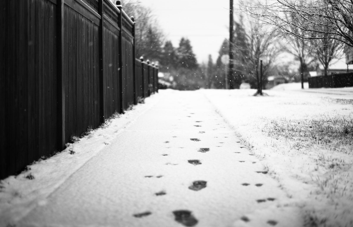
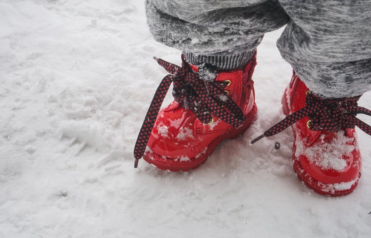
As we feared, Kitchener Council reversed itself last week, deferring the bulk of the winter sidewalk maintenance pilot for next year’s Council to consider. This means that the full and snow-event-only plowing options are off the table for the coming winter.
This decision will leave Kitchener without a fair comparison between different sidewalk maintenance options, allowing the information void to be filled by whoever is able to shout their political biases the loudest. Additionally, Council has opted to attempt proactive enforcement across the city. With variable weather from year-to-year, it will be harder to measure the true impact of the change.
We have encouraged city staff to do their best to monitor the efficacy of plowing the approximately 200 km of sidewalks the city does maintain on its own. This would allow for some comparison at least between enforcement option and something resembling full-plowing. However, we’re uncertain if staff will be given resources to adequately measure mobility conditions, beyond meeting minimum provincial requirements for monitoring.
The decision to flip-flop wasn’t the only thing disappointing about last Monday’s meeting. Councillor Galloway-Sealock, who moved the deferral, implied that she was discounting the opinions of residents who supported the pilot as unrepresentative, as if sharing TriTAG’s position was somehow disqualifying. Fortunately, your opinions can’t be so easily discounted at the ballot box October 22.
Take action
- Thank Mayor Vrbanovic and Councillors Marsh, Fernandes, and Gazzola for their steady support of the pilot.
- Make sidewalk maintenance a municipal election issue:
- Register to vote October 22
- Ask your candidates where they stand on sidewalk clearing at the door, by email, and especially at candidates’ debates. Put councillors who flip-flopped or opposed the sidewalk pilot on notice that you’re disappointed with their decision
- Keep an eye out for the TriTAG election survey and learn where the candidates stand
- Donate and volunteer for candidates who you feel best represent your values
- Write a letter to the editor in the Waterloo Region Record or the Kitchener Post
Week in review: June 28, 2018
Subscribe to get weekly updated delivered directly to your inbox!
Consultations, feedback, and events
- CYCLING:
- Your ideas wanted for a “minimum grid” of protected cycling routes
- Survey on updating the Ontario Traffic Manual Book 18: Cycling Facilities
- Kitchener’s Workshop on Wheels, July 28, 31, August 1, 11, 14, 16, 18, 20, 22, 25
- TRANSIT TALK: GRT’s New Directions, July 4, 16, 30, August 8, 15, 29, September 5, 10, 25
- KITCHENER: Strategic Plan Review, June 28 and online
- TREES: Kitchener’s Sustainable Urban Forest Strategy, due June 29
- VOTE: Check to see if you are registered to vote in the upcoming municipal elections
Snowed
After initially supporting a winter sidewalk maintenance pilot exploring proactive enforcement and plowing options in committee, Kitchener Council flip-flopped in the wee hours of Tuesday morning and voted 7-4 to not consider any plowing options this year. Shockingly, Councillor Galloway-Sealock, who moved the deferral, implied that she was discounting the opinions of residents who supported the pilot as unrepresentative, as if sharing TriTAG’s position was somehow disqualifying. Fortunately, your opinions can’t be so easily discounted at the ballot box October 22.
- Thank Mayor Vrbanovic and Councillors Marsh, Fernandes, and Gazzola for their steady support of the pilot.
- Does Kitchener City Hall belong in the snow business? (The Record)
- A clear sidewalk is a vital public service (The Record)
Transit
GRT has published ridership numbers for May – we’ve now had 10 consecutive months of higher ridership than the year before! The average year over year increase is 3.4%. GRT has also published new performance measures including overcrowding and missed service hours (due to collisions, mechanical failures, weather, etc.)
- What Doug Ford could mean for transit in Ontario (TVO)
- Region to do more work on the LRT route into Cambridge (The Record)
- In public transit, inefficiency equals exclusion (The Atlantic)
- The story of “micro transit” is a consistent, dismal failure (Streetsblog)
- The real benefits of real-time transit data (Sidewalk Labs)
- How to pass a mega transportation measure (LA County Metro)
- Why is public transport use higher in Australia than America and what to do about it (Transportist)
Cycling
- Kitchener taking to the streets to hear the good and the bad about cycling in the city (The Record)
- Sharing isn’t caring: shifting gears on shared responsibility (Robin Mazumder)
- ‘We know what needs to be done’— imagining a bike-friendly future (The Record)
- Infrastructure — not sundresses — responsible for low cycling rates among women (The Record)
- Cycling should not be a contact sport (Globe and Mail)
- Long a Canadian cycling mecca, Montreal’s future looks downright Scandinavian (The Star)
- Cycling popularity sees drastic rise in year since bike-lane launch (The Star)
- Here are the four elements of a cyclist-friendly ‘protected intersection’ (The Star)
- Be a voice for cycling in your community (Share the Road Cycling Coalition)
Vision Zero
- Crossing guard seriously injured after being hit by car in Kitchener (CBC)
- Advocate wants to see improvements for cyclists, pedestrians (CTV)
- Why the ‘distracted pedestrian’ is a myth (Curbed)
- Five changes Toronto (or our region and cities!) could make to improve safety for cyclists and pedestrians (Globe and Mail)
- We designed Canada’s cities for cars, not people – and the people are dying (The Guardian)
- We know how to make roads safer. We just have to do it. (The Star)
- #BuildTheVisionTO: Safe and active streets For all (TCAT)
A set of election priorities worth adopting here too. - Our roads will be safer when they are slower (The Star)
- 5 changes cities can make right now to reduce cyclist deaths (Motherboard)
The shape of our cities
- Office building to go up on site of adult rec centre in Waterloo (The Record)
- Ontario Die Company redevelopment approved by council (Waterloo Chronicle)
- Major redevelopment plan would transform Kitchener’s Fairview Park mall (Kitchener Post)
- Waterloo approves 25-storey tower in uptown (Waterloo Chronicle)
- Breithaupt office tower moves ahead, despite residents’ objections (The Record)
- Large housing, retail development OKed for northeast Waterloo (The Record)
- Office space, retail slated for historic post office site (Waterloo Chronicle)
- Affordable housing to be part of big project in Kitchener core (The Record)
- Parking rates to increase in Uptown Waterloo (CBC)
- Every city with “Goldilocks” parking fees (Reinventing Parking)
- “Unbundling” parking costs is a top way to promote transportation options (Mobility Lab)
- Why affordable housing is so important for development near transit (Streetsblog)
A summer call-to-action on winter sidewalks
This past week, the Kitchener Community and Infrastructure Services Committee approved a plan to pilot different alternatives for keeping sidewalks clear and accessible in winter. The plan would see the city test out proactive bylaw enforcement, full city plowing, and shared responsibility between homeowners and city contracted plows in various parts of the city. It’s an important first step in figuring out how to best ensure our sidewalks are open and safe year-round.
However, we’ve become aware of an intense lobbying effort to cancel the plan at Monday’s upcoming City Council meeting. Don’t let the naysayers dump snow on the path to equitable winter sidewalks – speak up for improving winter mobility!
A quick email or phone call to your councillors expressing your thanks for supporting the pilot would go a long way. Better yet, if you’re able to, attend the council meeting on Monday June 25 and register to delegate.
You can also help to spread the word on Twitter and Facebook. Watch for the hashtag #snowbilityWR and don’t forget to tag your councillors!

Week in review: June 12, 2018
Subscribe to get weekly updated delivered directly to your inbox!
Consultations, feedback, and events
- CYCLING:
- TREES: Kitchener’s Sustainable Urban Forest Strategy, due June 29
- VOTE: Check to see if you are registered to vote in the upcoming municipal elections
Election aftermath
The Progressive Conservatives have won a majority government in the Ontario Legislature. What does that mean for provincial transportation policy? Our best guess can be found in our review of party platforms and promises.
Walking
Kitchener staff have shared their plans to test winter sidewalk clearing options: proactive enforcement, plowing after every snowfall, and a hybrid of property owners and city-run clearing where plows are only deployed after major snow events. The study would also try out sensors that can detect the presence of sidewalk snow and ice.
- Kitchener welcomes new ‘rainbow crossing’ in downtown (Kitchener Post)
- Cambridge advisory committees clash over Blair Road turf war (The Record)
- When it comes to winning praise, Galt’s new bridge is a walkover (The Record)
- How traffic signals favour cars and discourage walking (The Conversation)
Cycling
Waterloo Regional Police have released a pair of videos containing tips for people cycling and driving to “share the road” safely. The cycling video has drawn criticism for admonishing “keeping to the right” at all times – in contradiction with guidance from the City of Kitchener regarding sharrows and the Ministry of Transportation’s own cycling safety guide, which discourage staying to the right if the lane is too narrow to share. According to provincial guidelines for transportation engineers and planners, “sharrows are intended to guide cyclists as to where they should ride within a travel lane shared by both motorists and cyclists.” We’re don’t tend to be fans of sharrows – too often they’re a cop-out for real infrastructure – but it’s disappointing to see our police contributing to the public’s confusion surrounding them.
- Velo Canada Bikes – Summary (London Bicycle Café)
- Copenhagenize your city: the case for urban cycling in 12 graphs (The Guardian)
- How bike lanes benefit businesses (Strong Towns)
- Engineering solutions for safer cycling: bike signal timing and crash prediction (Transportation Research and Education Center)
- Den Bosch keeps its arterials tidy with low-stress access roads (People for Bikes)
- Bike and transit are better than driving … when they team up (People for Bikes)
Transit
- Resumes pour in for LRT driver positions (The Record)
- Ride-shares, subsidized taxis eyed to improve transit in Waterloo region (CBC)
- Buses to connect 9 Perth County communities (CTV)
- Is anyone owed a transit line? (Human Transit)
- Dedicated bus lanes, without the extra lane (CityLab)
- Transit ridership depends on bus service, study finds (CityLab)
- Flagging down driverless buses (The American Prospect)
- Future-proofing public transit (Remix)
Vision Zero
- Toronto planning to allow photo radar outside all elementary schools (The Star)
- How fire departments stopped worrying and embraced safer street design (Streetsblog)
- False positives: self-driving cars and the agony of knowing what matters (Wired)
The shape of our cities
- New rules in Waterloo could threaten highrises, developers fear (The Record)
- Developer vows to fix 10-storey ‘mistake’ in student area (Waterloo Chronicle)
- Metal and glass addition planned for heritage building in downtown Kitchener (The Record)
- Can the Growth Plan’s Major Transit Station Area (MTSA) policy be the beachhead into the Yellowbelt? (Neptis Foundation)
- Challenging myths about millennials and housing (The Conversation)
- Why transit-rich neighbourhoods are more affordable (The Atlantic)
- “Unbundling” parking costs is a top way to promote transportation options (Mobility Lab)
Parsing the election platforms
The Ontario provincial election is just over a week away. At TriTAG, we don’t endorse particular parties or candidates. We recognize that your vote is a personal choice, informed by your own values and priorities. However, we do want to help you make an informed choice, so we’ve tried to compile what each of the major parties has promised for transportation (and related issues) in their platforms or announcements.
Inter-city transit
The Liberals have pledged $11 billion for high speed rail connecting London, Kitchener, Guelph, and Toronto by 2025. The NDP and the Progressive Conservatives have both promised to complete the environmental assessment for high speed rail, but have not committed to completing it. There is conflicting information from the Green Party regarding their support high speed rail.
The NDP explicitly list two-way all-day GO service to Kitchener as part of their platform, along with electrification of the GO network. They would also engage the federal government to better coordinate VIA and GO passenger services.
The Liberals’ GO Regional Express Rail and high speed rail plans also rely on electrification. (While the Liberal platform does not explicitly mention the Kitchener Line, infrastructure work necessary for high speed rail would also enable two-way GO service.)
The Greens believe two-way all-day GO could happen sooner than 2024, and have also pledged to support better inter-city bus connections.
The Progressive Conservatives have also pledged to fund two-way all-day GO and “cut red tape” to make it happen faster. However, part of the current provincial funding for GO electrification comes from planned carbon cap-and-trade revenues, which the party has vowed to scrap.
Local transit
Both the NDP and the Green Party have pledged to fund 50% of the net operating costs of local transit. The Greens also pledge $1-1.5 billion per year above the 2018 budget estimates for public transit infrastructure.
Liberals are promising reduced GO fares for short trips, cheaper transfers between municipal transit systems, and a seniors’ transit tax credit.
Aside from taking over the Toronto subway system and building more subway lines in the GTA, it’s not clear what the Progressive Conservatives’ plan for local transit is at this time. With promises to cut gas taxes, it’s unknown whether this puts puts budgeted plans at risk to increase municipalities’ share of gas tax to help fund transit.
Cycling and walking
The Liberals would spend $140 million on cycling infrastructure – this is likely the remaining balance of the $225 million pledged to municipalities as part of the climate change action plan.
The Greens would dedicate 5% of the transportation budget to walking and cycling infrastructure (which would work out to over $200 million annually). They would also spend $2.17 billion over four years on safer streets and roads.
The NDP would update the Ontario Cycling Strategy and set specific targets for cycling mode share and infrastructure spending. They would also pass their Vulnerable Road Users bill.
Since the Progressive Conservatives haven’t released a platform and we haven’t heard any announcements from the party pertaining to cycling or walking, we can’t say what a PC government would do. However, as the pledged cycling infrastructure funding in the provincial budget comes from cap-and-trade revenues, it’s possible that this may also be cut.
Roads and driving
The Green Party would introduce congestion pricing and parking levies to help cut traffic and fund transit and active transportation infrastructure.
Progressive Conservatives have promised to cut gasoline taxes by ten cents a litre by lowering fuel taxes and eliminating carbon pricing. As we note above, it’s not clear, but this could have negative implications for transit and cycling funding.
The NDP would lower auto insurance rates by 15% and end the practice of determining premiums by location. They have also promised to do something to slow the swings in gas prices.
The Liberals would continue expanding highways. They have also pledged to reduce auto insurance rates and remove location as a determinant for premiums.
Land use
The Progressive Conservatives have backtracked private comments suggesting they would open up the Greenbelt to suburban development.
The Liberals would expand the Greenbelt into the Waterloo and Paris/Galt moraine complex. They are also promising to continue with their plans to improve housing affordability and increase the supply of smaller multi-unit housing projects. Their infrastructure plan also includes bringing amenities like grocery stores and banks to GO station areas.
The NDP would build 65,000 new affordable units and would strengthen inclusionary zoning regulations.
The Green Party would also expand the Greenbelt and would require 20% of all newly developed units to be affordable.
Vote!
If you haven’t yet, find out where your polling station is to vote. Remember, you don’t need a voting registration card to vote, just ID showing your name and proof of address. You can also vote in advance already, but don’t forget to do so by June 7!