Big Changes for Bridgeport, Erb, Caroline, and Albert
There’s going to be another major road project coming to Uptown Waterloo.
Reconstruction of Bridgeport, Erb, Caroline, and Albert.
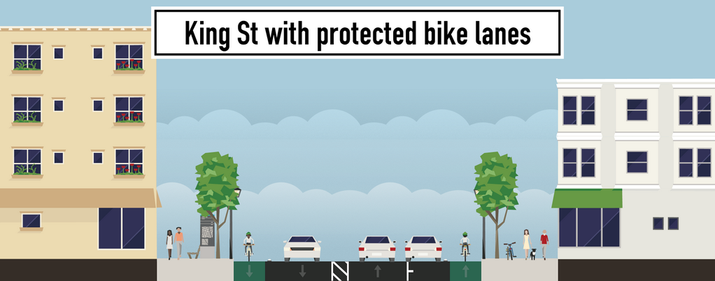
That’s right. After LRT construction wraps up in 2017, and after the King St improvements bring protected bike lanes to King St in 2018/2019, the city and region will be replacing aging services underneath Bridgeport, Erb, Caroline, and Albert, and are taking the opportunity to revisit the design of these streets as they cut through central Waterloo.
Here’s a look at what’s proposed, (page 46, 12MB PDF) and below we’ll talk about what works, what doesn’t, and what needs serious improvement.
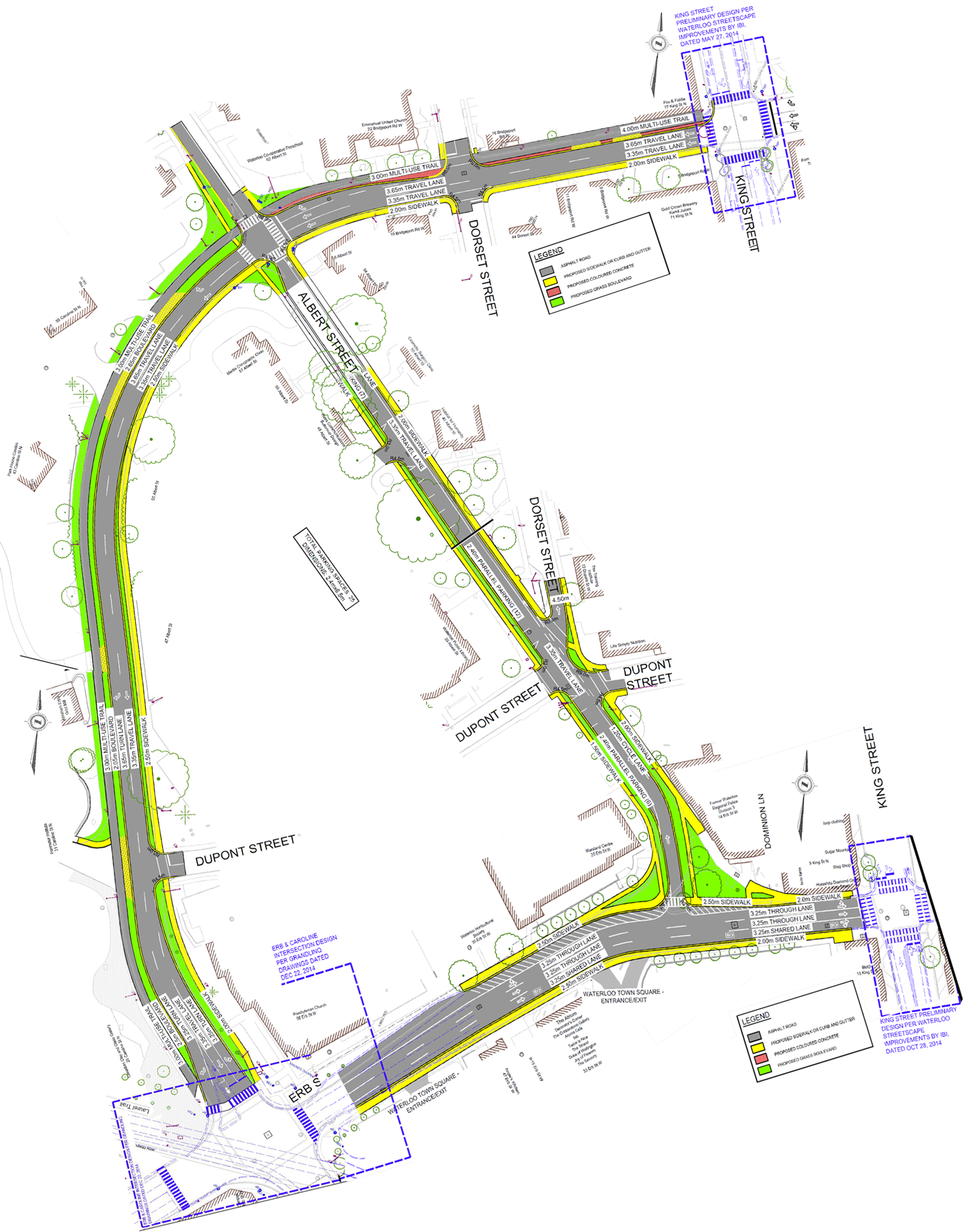
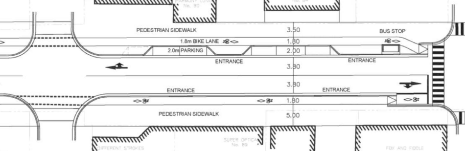
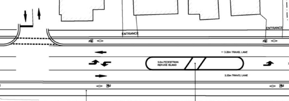
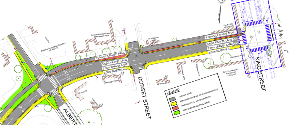
Concept plan for the reconstruction of Erb/Bridgeport/Caroline/Albert
Major changes include:
- A multi-use trail along the north side of Bridgeport/Caroline linking the King St bike lanes to the Laurel Trail at Erb
- Narrowing Caroline north of Erb St to two lanes, and adding a new sidewalk on the East side
- Narrowing Albert from two lanes to one, with a northbound bike lane and parallel parking
- Changing Albert/Erb to a T-intersection
- Sharrows on Erb St from Caroline to King
What Works
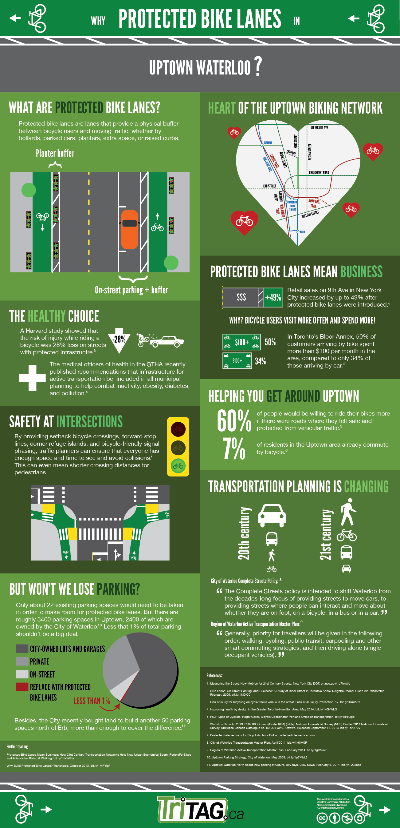
Adding a multi-use trail along Caroline provides a great bicycle link between King St and multiple trail entrances for Waterloo Park, and finally allows northbound cycle traffic up Caroline.
Crossing Albert on the north side of Erb will be made much easier. The current multi-lane off-ramp nature of Albert St is dangerous, making walking around the old Police Station unpleasant. The new T-intersection design reduces crossing distance, turning speeds, and even introduces new green space.
Reducing Caroline to two lanes helps solve the problem of traffic backing up in the right hand lane of Bridgeport east of King. Now traffic intending to go beyond King will use the centre lane, while those turning onto King and Regina Streets will be on the left and right hand lanes, distributing traffic better across the three lanes.
Potential Improvements
Albert St still needs a legal way to cycle southbound. By moving the parking to the east side of the road, there could be a contra-flow southbound bikelane on the west side, with the northbound lane shared between cars and bicycles, with a more appropriate use of sharrows. This also puts the parking on the traditional right-hand side, which will be easier for drivers to use. Parallel parking is tricky enough, and even more so when it’s on the opposite side of the car.
If the bicycle route along Bridgeport/Caroline is a multi-use trail, then why is there a southbound on-street bike lane and bike box approaching Erb? There is no way for bicycles to access the on-road bike lane from the trail, and if they could, it would be unsafe to merge cross the constant stream of right turning traffic. The intersection design assumes that cyclists are on the road instead of the multi-use trail, when the reverse should be true. We can’t keep ending trails at crosswalks, asking cyclists to dismount to continue. With the first cross-ride in Waterloo now in service at Erb/Peppler, there is now precedent for a two-way crossing on the west side of Caroline, which will finally allow the connection of the Laurel and Iron Horse trails.
What Doesn’t Work
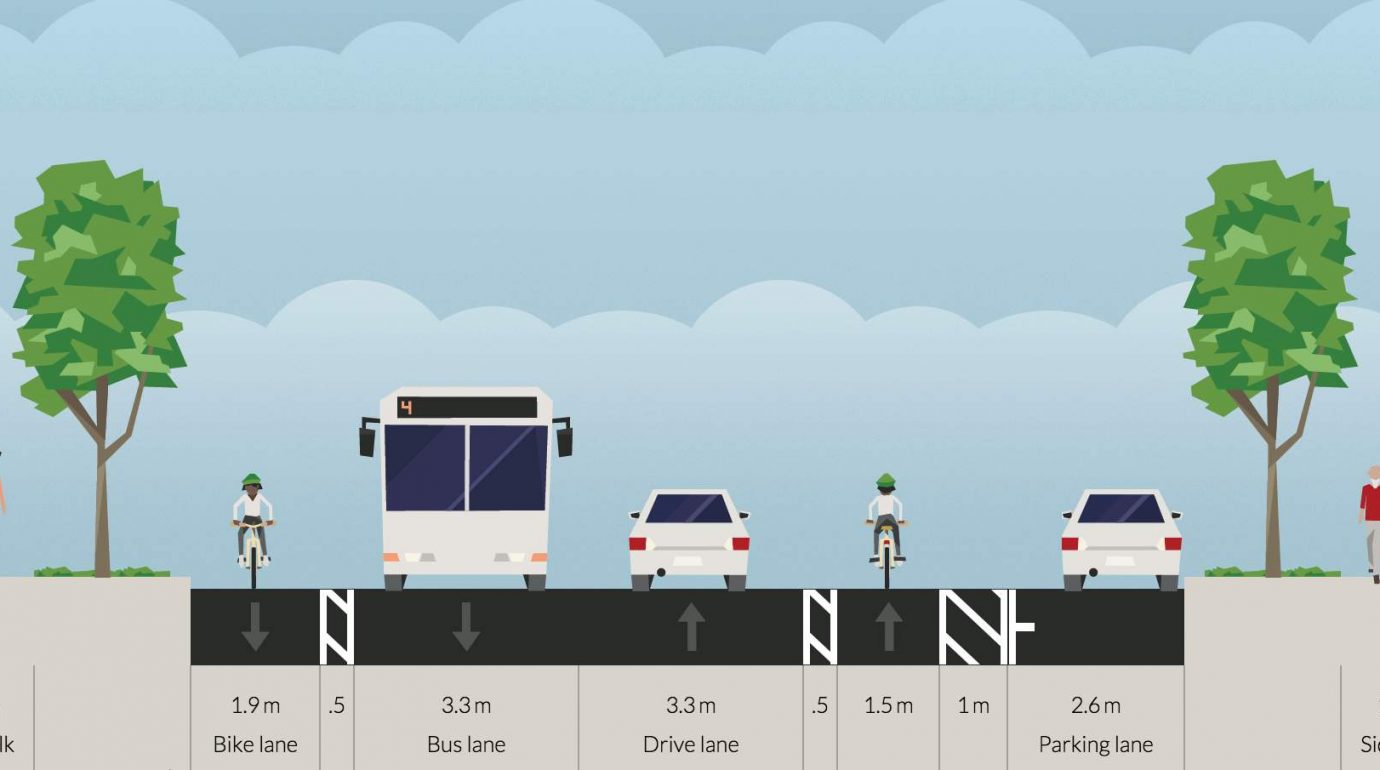
Erb St, unfortunately, has a long way to go.
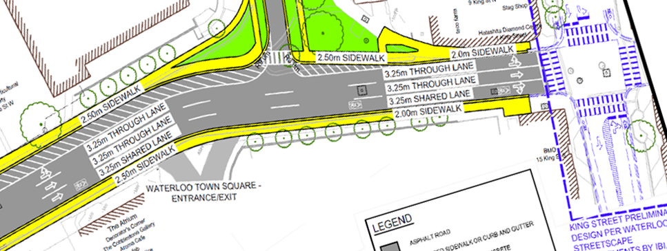
Erb, as proposed, with many lanes and large excessive shoulders.
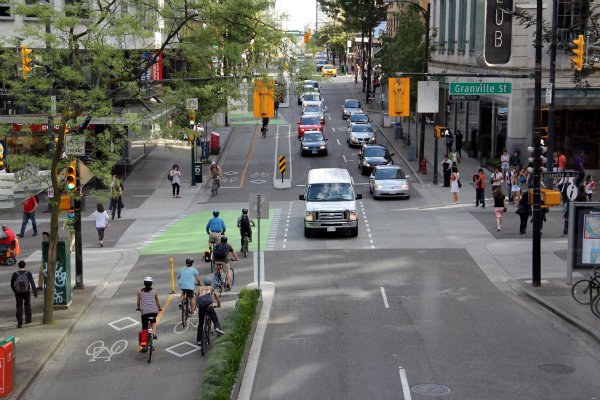
The sharrows proposed for Erb St are inappropriate. Sharrows work on low speed roads, not major high-speed multi-lane arteries. Sharrows are not a replacement for dedicated cycling infrastructure, and 2016 should be the year we stop pretending they are.
The width of Erb St is drastically wider than the planned use. There is no need for 3 through lanes and a painted shoulder lane. Staff mention a potential possibility for on-road cycle tracks, “without the need for additional construction,” but it would require waiting for “a separate, broader study to consider implementation of a two-way cycle track on Erb Street from Caroline Street to Margaret Avenue [which] will be completed by the Region of Waterloo in the future.” In the meantime, Erb will remain gratuitously wide.
A pedestrian crossing at Erb/Albert is dismissed, because there are fewer than 250 people crossing day, a number that is unlikely to change if Erb remains wide and hostile. Bridges are not built by counting the number of people swimming across a river; crosswalks should not be dismissed because few are willing to unsafely cross a high-speed 4-lane arterial.
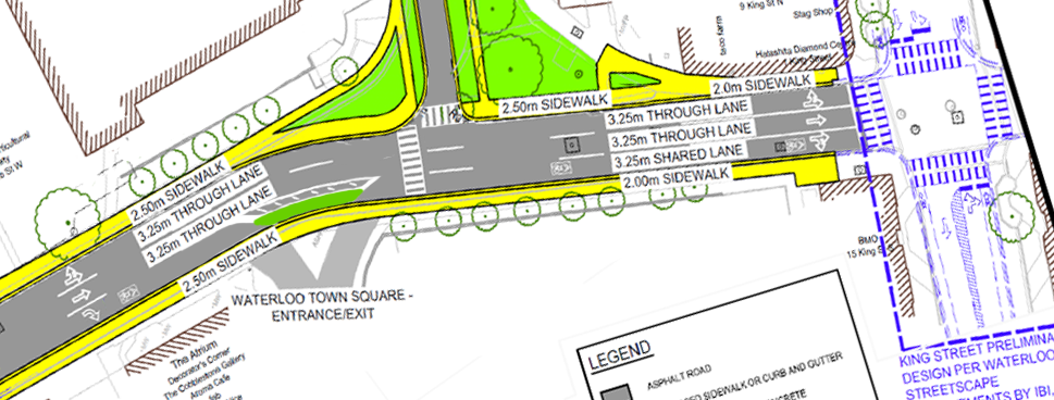
An alternate concept for a right-sized Erb St featuring a pedestrian crossing, and a shared bike and turning lane.
Here is a potential way to correct some of these issues. The right hand lane of Erb is used as a turn lane for the WTS entrance, and for King St. To prevent the speeding, cars cannot use it to drive from Caroline to King, only allowing cyclists to continue through, in what will now be a much lower-speed lane. The painted shoulder on the north of Erb is now removed, with the sidewalk moved south where it was. A pedestrian crossover is installed at Albert, allowing direct access from Albert to The Shops at Waterloo Town Square.
Send Your Feedback
These are just some of the suggestions that we have, but we’re sure you have more. Please send your own feedback, and be sure to attend the upcoming public information centre.
Feedback should be sent to:
Mr. Jim Ellerman, jellerman@regionofwaterloo.ca
Project Manager, Capital Projects
Regional Municipality of Waterloo
Mark Christensen, mchristensen@walterfedy.com
Project Manager
WALTERFEDY
Public Consultation Centre #1
Wednesday, January 27th, 2016
5:00p.m. to 8:00 p.m.
The Canadian Clay and Glass Museum
25 Caroline Street North, Waterloo