
Winter Sidewalk Study
TriTAG is pleased to release the results of our 2017 Winter Sidewalk Study. See our summary of our findings below, or read the whole report here. (more…)
TriTAG is pleased to release the results of our 2017 Winter Sidewalk Study. See our summary of our findings below, or read the whole report here. (more…)
You get what you pay for. It’s a pithy saying, but it holds a lot of truth – if you’re not willing to invest enough to make something work, it most likely won’t.
The phrase has significance to the proposed trail connection between the Iron Horse Trail and the future transit hub at King and Victoria. If costs become the sole focus in planning, this trail will not attract people to walk and bike along it to get to the hub. Unfortunately, that may be the road we’re going down, literally.
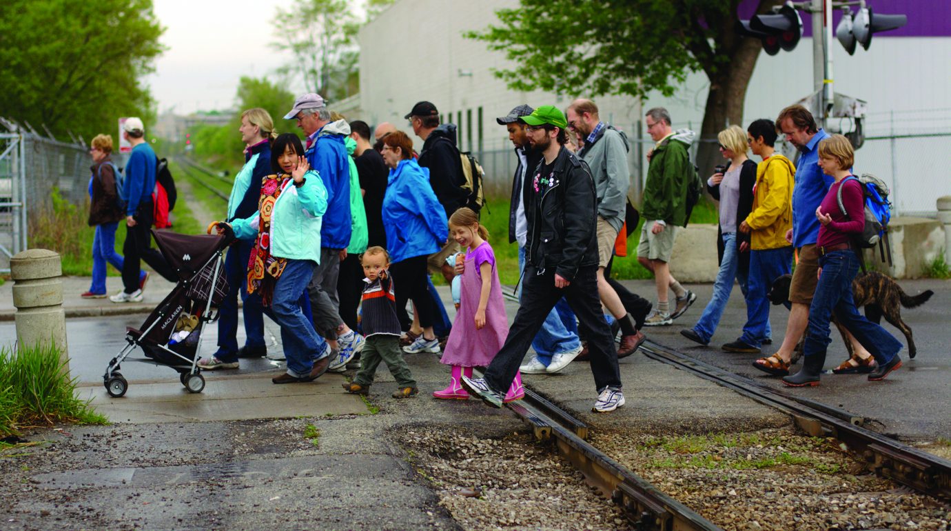
For one weekend every year, cities across the world play hosts to Jane’s Walks, a collection of walking tours of our urban areas to explore, discover, and learn. Anyone can host a walk, and there are plenty of themes.
This weekend, Waterloo Region will be host to dozens of different Jane’s Walks. Given TriTAG’s collective obsession with all things transportation, we thought we’d highlight a few for you! Click through for full walk details including length, meeting points, and other details.
As you’ll see, exploring the history of transportation in our cities is a common theme. This walk is led by the Waterloo Public Library’s Local History Manager, and will explore the ways people arrived at and moved around the Village, Town and City of Waterloo.
Not an actual walk, but on the other hand you’ll get to explore the City of Waterloo’s bike friendliness directly, with no other than Councillor Diane Freeman, long time advocate and supporter for better bike infrastructure. This trip on two wheels starts at the Market and goes to Uptown. If you’re interested, definitely click through for additional important details.
The history and ongoing development of this key piece of the central transit corridor, along with the direct and indirect impacts and influences of ION and intensification. What’s not to like?
If downtown K-town is more your beat, then let Todd Bowman lead you around the core and talk about the history, evolution and influences on the city of different transportation modes over the years, from walking and biking to driving and transit!
So get out there and see our cities! Jane’s Walks are a great way to connect with the places we live in and the people we live with. Just remember to bring an umbrella.

Our cities need to understand the extent of the problem that uncleared sidewalks pose to mobility and safety in winter. Unfortunately, the things they focus on give about as much clarity as a blizzard.
Nearly two years after City Council’s request, Kitchener staff have finally brought forward a report on winter sidewalk clearing. Their recommendation?
Do nothing. (more…)
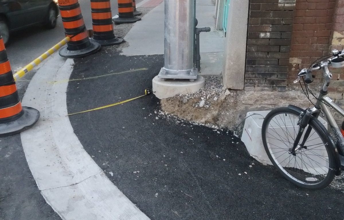
Yesterday, TriTAG member Mark Jackson-Brown shared a picture of the new corner of Queen and Charles: (more…)
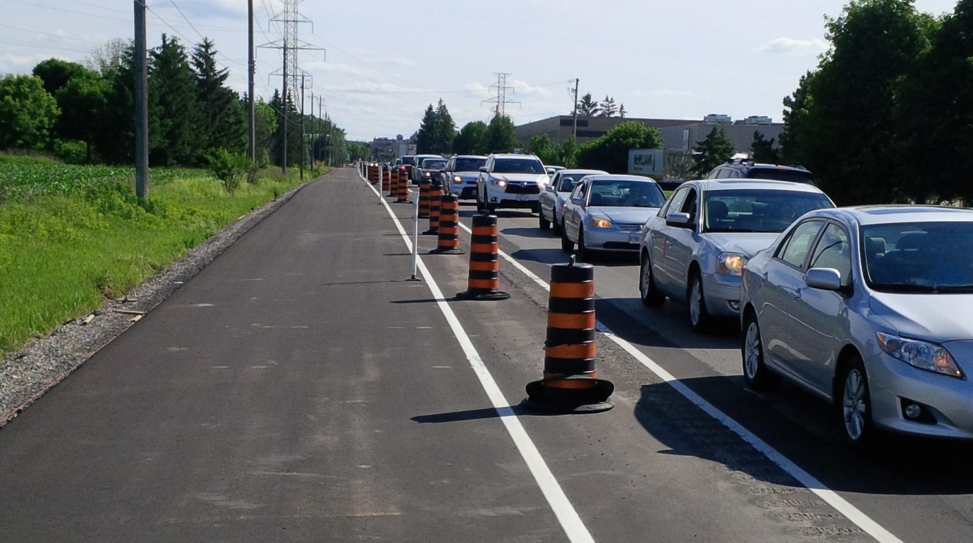
There’s going to be another major road project coming to Uptown Waterloo.
Reconstruction of Bridgeport, Erb, Caroline, and Albert.
That’s right. After LRT construction wraps up in 2017, and after the King St improvements bring protected bike lanes to King St in 2018/2019, the city and region will be replacing aging services underneath Bridgeport, Erb, Caroline, and Albert, and are taking the opportunity to revisit the design of these streets as they cut through central Waterloo.
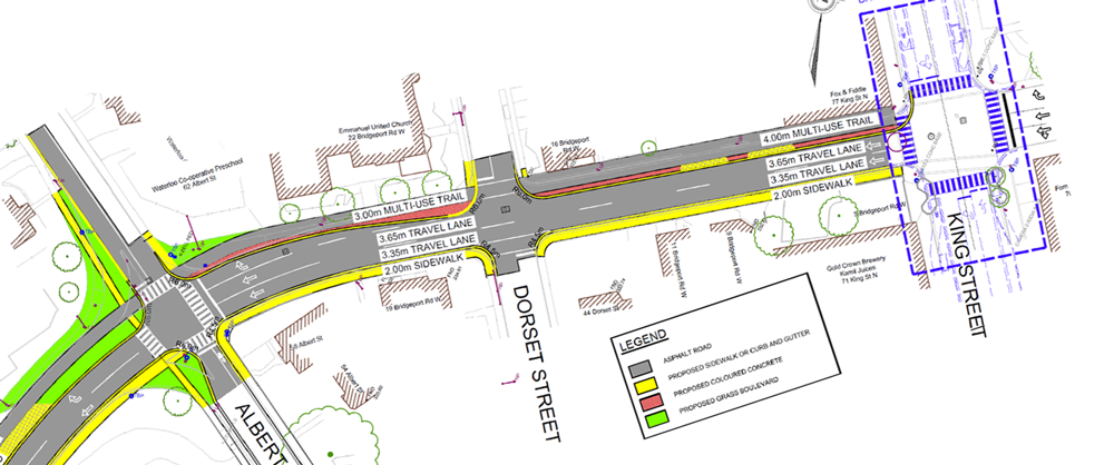
Here’s a look at what’s proposed, (page 46, 12MB PDF) and below we’ll talk about what works, what doesn’t, and what needs serious improvement.
Concept plan for the reconstruction of Erb/Bridgeport/Caroline/Albert
Major changes include:
What Works
Adding a multi-use trail along Caroline provides a great bicycle link between King St and multiple trail entrances for Waterloo Park, and finally allows northbound cycle traffic up Caroline.
Crossing Albert on the north side of Erb will be made much easier. The current multi-lane off-ramp nature of Albert St is dangerous, making walking around the old Police Station unpleasant. The new T-intersection design reduces crossing distance, turning speeds, and even introduces new green space.
Reducing Caroline to two lanes helps solve the problem of traffic backing up in the right hand lane of Bridgeport east of King. Now traffic intending to go beyond King will use the centre lane, while those turning onto King and Regina Streets will be on the left and right hand lanes, distributing traffic better across the three lanes.
Potential Improvements
Albert St still needs a legal way to cycle southbound. By moving the parking to the east side of the road, there could be a contra-flow southbound bikelane on the west side, with the northbound lane shared between cars and bicycles, with a more appropriate use of sharrows. This also puts the parking on the traditional right-hand side, which will be easier for drivers to use. Parallel parking is tricky enough, and even more so when it’s on the opposite side of the car.
If the bicycle route along Bridgeport/Caroline is a multi-use trail, then why is there a southbound on-street bike lane and bike box approaching Erb? There is no way for bicycles to access the on-road bike lane from the trail, and if they could, it would be unsafe to merge cross the constant stream of right turning traffic. The intersection design assumes that cyclists are on the road instead of the multi-use trail, when the reverse should be true. We can’t keep ending trails at crosswalks, asking cyclists to dismount to continue. With the first cross-ride in Waterloo now in service at Erb/Peppler, there is now precedent for a two-way crossing on the west side of Caroline, which will finally allow the connection of the Laurel and Iron Horse trails.
What Doesn’t Work
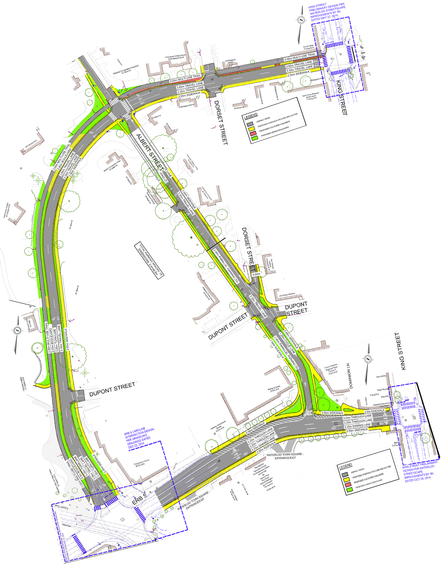
Erb St, unfortunately, has a long way to go.
Erb, as proposed, with many lanes and large excessive shoulders.
The sharrows proposed for Erb St are inappropriate. Sharrows work on low speed roads, not major high-speed multi-lane arteries. Sharrows are not a replacement for dedicated cycling infrastructure, and 2016 should be the year we stop pretending they are.
The width of Erb St is drastically wider than the planned use. There is no need for 3 through lanes and a painted shoulder lane. Staff mention a potential possibility for on-road cycle tracks, “without the need for additional construction,” but it would require waiting for “a separate, broader study to consider implementation of a two-way cycle track on Erb Street from Caroline Street to Margaret Avenue [which] will be completed by the Region of Waterloo in the future.” In the meantime, Erb will remain gratuitously wide.
A pedestrian crossing at Erb/Albert is dismissed, because there are fewer than 250 people crossing day, a number that is unlikely to change if Erb remains wide and hostile. Bridges are not built by counting the number of people swimming across a river; crosswalks should not be dismissed because few are willing to unsafely cross a high-speed 4-lane arterial.
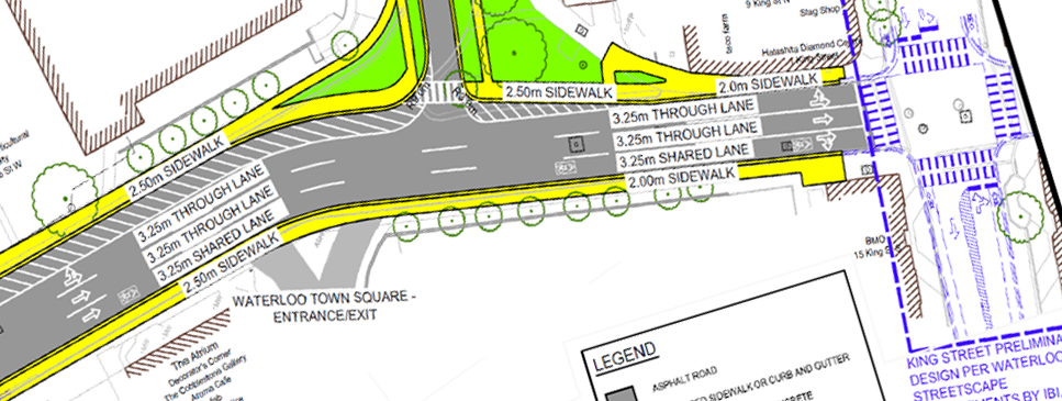
An alternate concept for a right-sized Erb St featuring a pedestrian crossing, and a shared bike and turning lane.
Here is a potential way to correct some of these issues. The right hand lane of Erb is used as a turn lane for the WTS entrance, and for King St. To prevent the speeding, cars cannot use it to drive from Caroline to King, only allowing cyclists to continue through, in what will now be a much lower-speed lane. The painted shoulder on the north of Erb is now removed, with the sidewalk moved south where it was. A pedestrian crossover is installed at Albert, allowing direct access from Albert to The Shops at Waterloo Town Square.
Send Your Feedback
These are just some of the suggestions that we have, but we’re sure you have more. Please send your own feedback, and be sure to attend the upcoming public information centre.
Feedback should be sent to:
Mr. Jim Ellerman, jellerman@regionofwaterloo.ca
Project Manager, Capital Projects
Regional Municipality of Waterloo
Mark Christensen, mchristensen@walterfedy.com
Project Manager
WALTERFEDY
Public Consultation Centre #1
Wednesday, January 27th, 2016
5:00p.m. to 8:00 p.m.
The Canadian Clay and Glass Museum
25 Caroline Street North, Waterloo
Northfield Drive East has a new multi-use path. The stretch between Wissler and Bridge previously was just a two-lane road with unpaved shoulders and no sidewalks or bike lanes. It was supposed to be widened this year to four lanes, with a sidewalk on one side, and a multi-use path on the other, but this work was deferred until work on the Northfield Highway 85 overpass could be completed, to avoid disrupting too much traffic all at once.
Because of this delay, the Region decided that allowing for active transportation on this road simply couldn’t wait. It has now paved the one shoulder to form this path on the south side of the road. It’s a creative and inexpensive solution to a significant gap in the active transportation network, while providing a significant level of protection to those on the path. (more…)
When I read the article this morning on our new Mayor’s viewpoint on sidewalk clearing, I was very sad. Two very crucial points stood out for me.
Whether or not our Council decides that clearing sidewalks is right for our City, or if building a new arena is the answer, or investing more into the economy or the arts, these decisions cannot be decided upon by the costs of the LRT. I feel a sense of deja vu, back to the RIM Park days when our City Council was held hostage to the RIM Park financing costs and were reluctant to move forward on any other spending for fear of the public backlash.
Trust me, I know that Council should always consider spending and how it will affect the tax payer, but it should not, and cannot be the only consideration.
The second point that stood out for me, was the Mayor’s comment that we can’t move forward because there is little public interest. The following is from the City of Waterloo’s own Transportation Master Plan:
‘From a Complete Streets perspective and developing a “City that is accessible to all”, there is a fundamental need to ensure that public sidewalks are accessible to all through timely and consistent removal of snow and ice. Winter maintenance has been an issue raised by the community under this TMP and the number one issue raised by the Grand River Accessibility Advisory Committee.
Expanding the City’s current sidewalk snow clearing program would promote and enhance safe and accessible pedestrian movement, encourage greater pedestrian and transit use and help make the shift to alternative modes of transportation. This would ultimately reduce the negative impacts and costs to widen more roads and intersections. A phased approach to implementing an expanded program would assist in the budgeting of this program, therefore the focus would be on higher
pedestrian and transit routes. Recommendations of this TMP include reviewing current city practice to identify efficiencies in service, an increase in the existing sidewalk snow clearing program of $100,000 per year over the next five years, subject to the 2012-2014 budget process, and develop a mid to long term strategy to expand the program where necessary. ‘
4 years ago, public input showed that clearing sidewalks mattered and should be considered in order to make our city more accessible. And that public interest, as far as I can see, has only grown in the last four years. not waned. It is an important piece for accessibility when we live in Ontario, and snow is a reality for upwards of 5 months out of the year.
Sorry Mayor Jaworsky, it is time for our City to embrace this change.
Janice Moore is the former chair of the City of Waterloo Recreation and Advisory Committee, and a current member of Waterloo’s Active Transportation Committee.
A lot can change in a week or two. When TriTAG set better winter sidewalk maintenance as one of its priorities for the year, seeing political movement on the issue seemed almost beyond reach. But thanks to your letters to councillors, the path has been cleared to real public debate about where our community’s priorities lie with winter mobility.
Here’s a breakdown of the story so far:
On Tuesday of last week, The Record published a column by Professor Alejandro López-Ortiz calling on our cities to plow sidewalks like they do roads. This week, Kitchener Post columnist James Bow also called on Kitchener to investigate offering this service.
After seeing the positive public response to López-Ortiz’s column, TriTAG published its councillor contact form, allowing you to raise the issue with your representatives. Many of you did.
We also searched our past municipal election surveys to remind you of what your elected representatives promised regarding winter sidewalk maintenance.
In response, Mayor Berry Vrbanovic and Kitchener City Council voted to review its sidewalk clearing policy, and reconsider the possibility of plowing sidewalks as other cities like London and Mississauga do. Regular Record columnist Luisa D’Amato praised the move as part of the mayor’s broader approach to governing. Councillor Dave Schnider also invited feedback from the public:
@TriTAG @berryonline asked for an updated report to be brought to council. I've been taking comments & ideas dave.schnider@kitchener.ca
— Dave Schnider (@DaveSchniderKW) February 24, 2015
Meanwhile in Waterloo, Councillor Brian Bourke put out an online survey to gauge public support for changes to sidewalk policy and how to pay for it. At the time of this post, more than three quarters of respondents support the city plowing sidewalks, with nearly two thirds in support of a tax increase of at least $20 a year to pay for it. Councillor Bourke also appeared on the 570 News Midday Show to discuss the pros and cons of the city taking on this responsibility. Waterloo has yet to direct staff to study sidewalk clearing, but it is encouraging to see members of council begin to open up the discussion.
We’ve only just gotten the ball rolling by getting municipalities to consider sidewalk plowing as a possibility. We need to continue to engage with our public officials and help them evaluate the options that municipal staff lay out in the coming months. Please consider taking a few minutes to write to your elected representatives and supporting sidewalk clearing as a Regional priority, so that this story ends with sidewalks that are accessible to everyone.
Last year, we surveyed municipal election candidates on a number of questions regarding transit, walkability, bicycling, and development. Below are what some of our current representatives had to say about keeping sidewalks usable in winter. If you’d like to get in touch with your councillors to talk about winter sidewalk maintenance, you can do so with our contact form.
“As our community ages, and from an accessibility improvement point of view, I am also prepared to engage our community and again look at city-wide snow clearing of sidewalks as a possible future service enhancement.”
– Berry Vrbanovic, Mayor of Kitchener