Photo (c) 2010 James Schwartz on Flickr, licensed under CC-BY-ND.

Signs, signs, everywhere a sign

Regional staff think they can reduce bike crashes with ‘cyclist dismount’ signs. Provincial guidelines say that’s a bad idea.

It’s no surprise that over half of all collisions between bikes and cars take place in crosswalks. It’s partly why our local municipalities have opted to prohibit sidewalk cycling in their bylaws.

Some might argue it’s the victim’s own fault if they’re struck while biking in a crosswalk, as they’re willfully breaking the rules of the road. But when it comes to other issues of public health, such as smoking, substance abuse, or even sedentary lifestyles and poor diets, we don’t allow a person’s choices to prevent us from trying to protect them from unnecessary illness, injury, or death.

Preventing traffic violence should be no different.  In fact, traffic engineers recognize that they can’t just expect drivers to perfectly follow speed limits or obey signs to protect themselves, but have to apply good design and analysis to protect drivers from their own mistakes, (not to mention their passengers or others on the road). This may involve changing the environment so that mistakes are less deadly, or changing the factors which influence people to make those mistakes in the first place.

Each year as part of the Region’s collision report, the top locations for crashes are determined for people driving, walking, and biking, and countermeasures are considered to try to reduce frequently encountered types of collisions. For top collision locations for cars, changes  including conversions to roundabouts, addition of left turn lanes, and dedicated turning phases are considered. For many of the top locations where people walking are struck, better lighting, countdown timers, more visible markings, and crosswalk relocation are all on the table. For King and Cedar, where several people biking with the sharrows have been struck by turning cars, staff are considering restricting certain turns.

Cyclist dismount sign

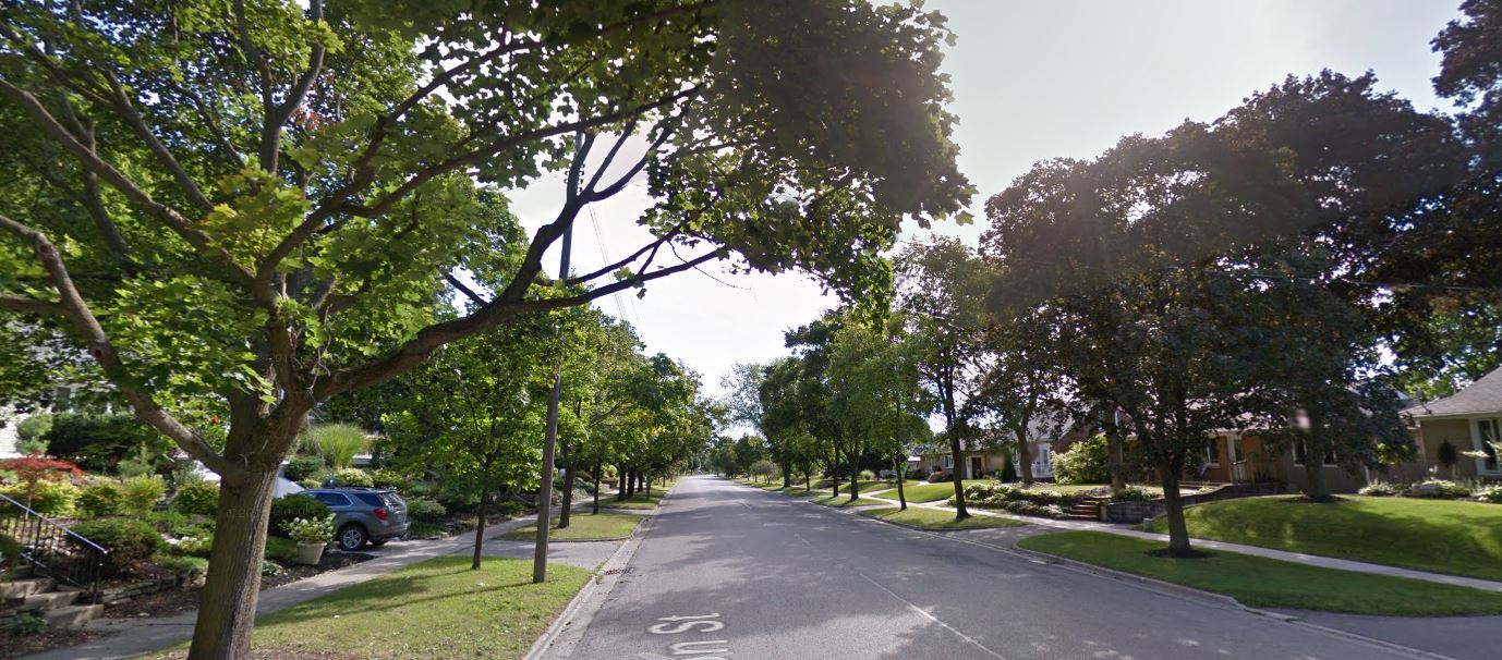
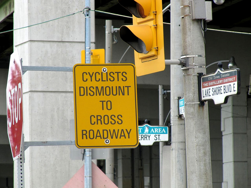
This sign is used to tell people biking to dismount and walk, which the Ontario Traffic Manual discourages. Photo (C) 2011 Richard Masoner on Flickr, licensed under CC-BY-SA.

But when it comes to people getting hit by cars while biking in crosswalks, it seems the best staff think they can do is put up a bunch of ‘cyclist dismount’ signs.

The province’s bicycle facility guidelines discourage installing ‘dismount’ signs because they aren’t frequently obeyed, and worse, can influence people to ignore other signs and signals:

“The option of asking cyclists to dismount and walk their bikes should not be relied upon in lieu of adequately accommodating cyclists through appropriate road design. Being propelled by muscular power, cyclists more than other vehicle operators will prefer to sustain their momentum and avoid stopping. Cyclists usually find it difficult to rationalize why “dismount and walk” restrictions are in place, and conclude that they were a poor, illogical or arbitrary decision. Thus, if facility designs cause cyclists to make what they consider to be unnecessary stops, this will increase the likelihood that they will ignore or disobey traffic controls, which breeds disrespect for these devices.”

Ontario Traffic Manual Book 18, 1.5 Cycling Myths, page 9

There are several other important reasons why putting up dismount signs aren’t a great idea:

  1. It ignores the real source of the problem. Many of these collision locations are terrible places to bike, leading many to conclude that it’s safer for them to use the sidewalk than the road. Protected bike lanes along these roads, coupled with good intersection design would go a long way towards improving safety.
  2. It implies cycling on the sidewalk is otherwise acceptable.  Putting up signs for cyclists who are on sidewalks would suggest they are expected to be there, which isn’t the case. Even if people biking obeyed the signs and walked their bikes, there would still be conflicts between people walking and biking on sidewalks.
  3. It’s not a viable solution for when sidewalks are changed to multi-use trails. The Region is increasingly looking to using wider multi-use trails in place of sidewalks and bike lanes on busy roads with no driveways. One of the top collision locations, Ottawa at the Laurentian Power Centre entrance, is expected to get multi-use paths sometime around 2020. If we are going to build pathways along roads, we need to design intersections to accommodate people who bike, not effectively ignore them.

Sometimes, paying attention to the actual factors that change behaviour and influence collisions is hard, and putting up signs can make us feel like we’re doing something. Preventing people from being struck by cars in crosswalks requires more than just tsk-tsking them for not dismounting from their bikes, but appropriate infrastructure with good design to accommodate them. We hope to find better solutions in future collision reports.

Headline photo (C) 2010 James Schwartz on Flickr, licensed under CC-BY-ND 2.0.

Read More »

12243107_10153767507602959_2683524994949553066_n

Stage 2 ION light rail public consultations Nov 18-19

Help the Region of Waterloo plan Stage 2 of ION light rail from Kitchener to Cambridge. The Region is conducting a Transit Project Assessment and needs your opinions and input at two upcoming public consultations:

  • Nov 18 – Cambridge City Hall, Bowman Room
  • Nov 19 – Kingsdale Community Centre

For more details, read the consultation handout or visit stage2ION.ca

Stage 2 ION light rail alternative routes

Stage 2 ION light rail alternative routes

Read More »

union-street

Kitchener’s Cycling Master Plan at risk: who owns the street?

Could a vocal opposition  prevent Kitchener’s cycling network from being connected and useful?

Kitchener City Council will be voting on whether to put bike lanes on Union Street (Margaret to Lancaster) on Monday, October 5 at 7pm. While Union has been approved as part of the bicycle priority network in Kitchener’s Cycling Master Plan since 2010, and a tentative design was approved last month at the Community and Infrastructure Services Committee, opposition from some residents threatens to overturn these plans, putting the priority network as a whole at risk.

Last month, in the face of vocal opposition, Kitchener City Council opted to shelve a staff-recommended design for buffered bike lanes on Westheights Drive in favour of a compromise design that preserves parking on both sides of the street. While the compromise design affords some improvement to the experience of cycling on the street and could contribute to safer traffic speeds, the decision has made those who advocate for a useful and safe cycling network concerned about future decisions.

The compromise decision was not made on technical merits, but rather on political considerations. Based on data collected systematically by City staff for on-street parking use, reducing parking to one side of the street would have been more than sufficient for resident needs. But to the residents who protested to Council, this wasn’t enough, so Council sought a solution that would satisfy them.

It may be easy to assume that Westheights was a good example of democracy at work: the people spoke, and Council listened. But scratch the surface a little, and you will find this interpretation problematic.

First, it assumes that the opponents who appeared at Council represent the actual majority view of the residents of the street. This is betrayed by the City’s own survey of Westheights residents which found greater numbers in support to the recommended changes than were opposed. (Dissenters claim to have conducted their own survey that showed the opposite, however it’s important to take this resident-led survey with a grain of salt. Given how some supportive voices were intimidated into silence by belligerent opponents during initial neighbourhood consultations, one can easily imagine many residents nodding along to an angry neighbour on their doorsteps for fear of that hostility being directed towards them. Additionally, given the charged rhetoric used to discredit the buffered bike lane design – the ‘super cycle lanes’ and the exaggerated ‘dangers’ of having to cross the street to park – it’s not surprising this survey solicited a more negative response.)

Second, even if the delegates were truly representative of the residents of the street, giving them final say over a street’s design privatizes the public realm and excludes many other important stakeholders. To be sure, those adjacent to a street are important stakeholders, and should be consulted. But a street does not exist merely for the benefit of the property owners along it, but for the public at large. In the case of Westheights and Union, traffic counts reveal that thousands more residents and visitors from surrounding streets and neighbourhoods use the roadway than just those from properties lining these streets. Unfortunately, the City’s own consultation processes, by engaging predominantly with residents from the street itself, feeds this perception that these collector roads are for their private benefit. It may be challenging, but future consultation efforts should attempt to reach out more to the broader cross-section of a street’s current and potential users to get a more representative view of public desires and needs.

In the case of Union Street, there simply isn’t enough space for a compromise like Westheights to accommodate parking on both sides and still have usable bike lanes. And reducing the parking supply to one side still leaves nearly four times as much parking as there is demand. But like Westheights, we anticipate opposition to this change to be fierce.

Fortunately, you can help to bring safe cycling facilities to Union and ensure that the priority network is not compromised. Probably the two most effective things you can do is show up in the Council chamber Monday night and be visible, and if you’re really keen, register to delegate. If you can’t make it, you can also write to your councillors and remind them that you too are a stakeholder in the form that Union Street will take.

Read More »

An alternative design for University Avenue

In our last post, we raised some concerns with the Region’s recommended design for the reconstruction of University Avenue between Erb Street and Keats Way.  In particular we have issues with the inadequate separation from motor traffic, and the ability to maintain the lanes in winter.  Here is a quick overview of a design that we believe better addresses these issues.

Illustrated below is the Region’s recommended design.  It features 1.5m bicycle lanes separated from motor traffic by 0.6m buffers.  It also includes sidewalks on both sides of the street – there is currently only a sidewalk on the east side.

University Ave - Erb St to Keats Way, ROW proposal, looking northeast

Region of Waterloo staff recommended design alternative for University Ave

To address our concerns regarding bicycle-car separation and winter maintenance, we would prefer that the bicycle lanes be moved off the main roadway.  Illustrated below is a road layout that takes up the same space as the region’s proposal but provides bicycle paths separate from the main roadway.

Improved University Ave - Erb St to Keats Way, looking northeast

Improved design alternative for University Ave with separated bicycle paths

This arrangement replaces the two one-way bicycle lanes with two one-way bicycle paths.  This type of infrastructure is common in the Netherlands, where it is allows people of all ages and abilities to cycle to their destinations even along fast and busy roads.

In this arrangement, the boulevard forms the buffer between bicycles and cars, freeing up the space from the two 0.6m painted buffers to be used for other purposes, such as widening the bicycle path.  It is important to note that off-street bicycle paths need to be wider than painted lanes, since cyclists do not have the option to leave the lane to overtake a slower cyclist.

Unlike in the region’s plan, we do not propose to add a new sidewalk on the west side of the road.  There is no access to the properties on the west side, and there are few origin-destination pairs that would make for a competitive walking trip.  As a result, the potential volume of pedestrian traffic would be minimal.

With so few pedestrians, it’s hard to justify building and maintaining separate pathways for pedestrians and cyclists.  The handful pedestrians that would walk along the west side of the road would not be inconvenienced by walking on the bicycle path, nor would cyclists be inconvenienced by such a small number of pedestrians on the bicycle path as long as it is sufficiently wide.

To complement this shared arrangement, there needs to be thoughtful intersection design.  The current standard designs for multi-use paths where the path ends at intersections and cyclists are expected to dismount are not acceptable. Fortunately, there are good examples of how to integrate off-road bikeways with intersections.

Omitting the west sidewalk saves 1.8 metres in the first improved design alternative, which can be allocated instead to widening the boulevard and the bicycle paths.  But this is not a critical component of the design.  There could be sidewalks on both sides, or on neither side, and the effect would be generally the same.

The end result of this design would be to make cycling along this segment of University Avenue an attractive option for people of all ages and all levels of interest in cycling.  While the remainder of University Avenue will remain hostile for now, we urge the Region to use this project as a first instance of a new standard of cycling infrastructure for arterial roads that is safe and comfortable enough for everyone.

Read More »

university

Could University Ave slip through the cracks?

On Tuesday, Regional staff will be presenting a report to the Planning and Works Committee, recommending the widening of University Ave between Erb St and Keats Way from 2 lanes to 4, and the addition of a new sidewalk to the west side where none currently exists. However, while staff had considered some sort of protected bike lanes or cycle tracks, the report rejects them in favour of on-street bike lanes with a narrow buffer.

While these on-road buffered bike lanes offer slightly more separation than the existing lanes, and are similar to ones we have supported for Westheights Drive, the context of University Ave makes them less appropriate. University has a speed limit of 60 km/h (which means speeds are typically higher), and sees four times as much traffic during the day. Based on these characteristics, the Ministry of Transportation’s guidelines on bicycle facility design strongly recommends considering segregated bike lanes, cycle tracks, or in-boulevard facilities. The lack of intersections and driveways also makes this block a prime candidate for protected bike lanes or boulevard multi-use pathways (which are less expensive than widened roadways and sidewalks).

So why are staff recommending on-street lanes? The report states that,

“University Ave. both north and south of the project currently has on road bike lanes and it makes the most sense for this portion of University Ave to maintain an on-road bike lane for continuity with the adjoining sections.”

At WaterlooBikes, Narayan Donaldson calls this  justification “the most absurd I have ever seen in a Canadian traffic engineering report.” Basically, we can’t do much to improve the cycling facilities on this section of University Ave, because we have lousy cycling infrastructure at either end – infrastructure where Tiberiu David was struck from behind and killed while riding his bike in 2010.

Donaldson goes on to give examples of where fully protected cycling facilities have been successfully transitioned with on-street lanes, demonstrating that integrating on-street lanes with fully protected facilities is in fact possible.

Why do recommendations like these happen?

Because no one’s paying attention. 

The report notes that only three people attended the public consultation back in November. As much as we like to think we have a Regional government that somewhat ‘gets’ the need for good active transportation infrastructure, as with any large organization, change really only occurs when people stand up and demand it. It’s plausible that after the poor attendance, the staff responsible may have concluded residents didn’t consider this stretch of road to be all that important, despite whatever latent demand may exist.

The Region itself may no longer have the staff resources to keep an “eye on the ball” for active transportation projects like this either. The planner and engineer responsible for developing the Active Transportation Master Plan, along with both Transportation Demand Management planners have either transferred to different departments or to other municipalities, and to our knowledge, none of these roles have been replaced. This void may also be the reason why the Active Transportation Advisory Committee has not been consulted on this project. We hope that as the Region establishes its priorities for this Council term, it will ensure that it has the people it needs to oversee the successful implementation of the ATMP.

The good news is that there’s still a short window of opportunity to change the course of the University Ave project, as Regional Council has yet to vote on the recommendation. Why not reach out to your councillors, or speak up at Tuesday’s committee meeting, and let them know you’re paying attention, and hope they will too.

Read More »

westheights

Westheights Drive

It’s been a quiet little while on the civic front. While construction season has been in full swing, the decisions and debates that guide the placement of buildings and the design of our streets take a bit of a summer vacation each year, as municipal councils take time off.

But within a week, the gears of local democracy will begin to spin once more, carrying us to Westheights Drive in Kitchener. On Monday, the City’s Community and Infrastructure Services Committee will consider a proposal to make Westheights less like a racetrack and more like a bicycle-friendly neighbourhood street. The proposal would not require any new infrastructure, but would take the current four-lane road and re-allocate the space to make room for bike lanes buffered from traffic, dedicated on-street parking spaces, and school bus loading areas.

As is often the case, thinking differently about how the space on our streets is used can be challenging for many, even if the street has been a ‘priority’ in the Cycling Master Plan for the last five years. Committee approval (along with final Council approval the following week) would ensure that the project is completed this year. We’d encourage you to contact your councillors or even come to the committee meeting on August 10 to voice your support for better streets.

On a related note, the decision regarding a similar design for Union Street (between Margaret and Lancaster) has now been deferred until August 31. Opposition has sprung up to the proposal, despite there being no changes in traffic capacity or risk of parking undersupply. It is important that councillors and staff hear your support for changes like these – please consider taking a moment to let them know you’d like better bicycling facilities and a safer environment for Union Street as well.

Read More »

northfield

A brief look at the new Northfield multi-use path

Northfield Drive East has a new multi-use path. The stretch between Wissler and Bridge previously was just a two-lane road with unpaved shoulders and no sidewalks or bike lanes. It was supposed to be widened this year to four lanes, with a sidewalk on one side, and a multi-use path on the other, but this work was deferred until work on the Northfield Highway 85 overpass could be completed, to avoid disrupting too much traffic all at once.

Because of this delay, the Region decided that allowing for active transportation on this road simply couldn’t wait. It has now paved the one shoulder to form this path on the south side of the road. It’s a creative and inexpensive solution to a significant gap in the active transportation network, while providing a significant level of protection to those on the path. (more…)

Read More »

Photo credit: Paul Krueger on Flickr

Upcoming events and public consultations

A number of events and opportunities for public feedback are happening over the next week and a bit.

Protected bike lanes for Uptown goes to Regional Council

After being approved last month by City of Waterloo Council, the recommended design for Uptown King Street is now up for approval by Regional Council. In addition to the portion from Erb to Central which the City approved, the Region will also be deciding the design of King from Central to University, and from Erb to the ION tracks and the Spur Line Trail. The recommendation contains more conventional bike lanes for this short stretch from Erb to the Spur Line, but it provides ample buffering to avoid conflicts between bikes and opening car doors.

While it is likely that the recommendation will be endorsed by Regional Council, (the Uptown BIA, Laurier, the City of Waterloo, and many in the community are in support), it appears there are some delegates registered who might object to the design. If you have the time to show up at Council, or send a quick email in support, we’d encourage you to do so.

Date: Tuesday June 16, 2015, 8:45am
Location: Council Chambers, Regional Headquarters, 150 Frederick Street, Kitchener

cow station area planningCity of Waterloo ION station area planning open house

The City of Waterloo is developing plans for zoning and infrastructure around ION stops to maximize the potential of rapid transit and develop transit-supportive neighbourhoods. They are hosting a public open house to provide input.

Date: Tuesday June 16, 2015, 5:30-7pm
Location: Luther Village (139 Father David Bauer Dr, Waterloo). Great Hall room

Columbia/Lexington EA deadline for comments June 17

The deadline for comments on the proposed design for Columbia and Lexington is June 17.  The preferred alternative includes a multi-use path from Davenport across the highway to Holbeach (where signage will direct people biking  to the Forwell Trail), but would not connect directly with cycling infrastructure on Columbia on the far side of King Street for the foreseeable future.

Travelwise Bike to Work Breakfast

Travelwise is hosting a bike-2-work breakfast here at the Tannery on Wednesday, June 17, from 8:00 AM to 9:30 AM. Roll in on your bike to get free food, free bicycle tune-ups, and demos on how to use the Community Access Bikeshare.

Date: Wednesday June 17, 2015, 8-9:30am
Location: Front of the Tannery next to The Firkin

Two cycle track options for Fischer-HallmanFischer Hallman from Bleams to Plains public consultation

The Region is considering changes to Fischer-Hallman in south Kitchener, and are hoping to include new bicycling and walking infrastructure in the design. The area is planned by the City of Kitchener as a future mixed-use corridor. New options being considered are multi-use paths, on-road protected bike lanes with raised curbs, and off-road protected bike lanes.

Date: Wednesday June 17, 2015, 4:30-7:30pm
Location: Kitchener Portuguese Club Inc, 1548 Fischer-Hallman Road, Kitchener

Alpine to Hanson/Hayward pedestrian connection public consultation

A pedestrian connection is being proposed to connect the Alpine Village neighbourhood with the Hanson/Hayward industrial area. This connection would provide transit access to organizations such as the Family Centre and Family and Children’s Services, as well as the industrial employers in the area.

Date: Thursday June 18, 2015, 4:30-7pm
Location: Activa Sportsplex, Murray Fried Room, 135 Lennox Lewis Way, Kitchener

“25 Ways to Brighten Your Community: Common Sense Steps for a Stronger, Greener, More Connected and Fun Waterloo Region” with Jay Walljasper

The latest ION Community and Transit Talk will be given by award-winning community builder Jay Walljasper, who will share the insights and inspirations he has collected from all over the world that are helping everyday people make a difference in their neighbourhoods by working together to implement community building and place making projects. His presentation will be followed by a short question and answer session.

Date: Thursday June 18, 2015, 7pm
Location: Knox Church, 50 Erb St. W., Waterloo

“Make it Happen: A Community Builder’s Workshop” with Jay Walljasper

Passionate community builders interested in shaping the future of Waterloo Region are invited to join Jay for a full-day workshop. In the morning, you’ll connect with other community builders from across Waterloo Region, brainstorm and dream big. Then, in the afternoon, you will roll up your sleeves and find ways to put your community-building aspirations into action to collectively reimagine and reinvent public spaces along the ION corridor and throughout Waterloo Region.

Date: Friday June 19, 2015, 9am-3pm
Location: Knox Church, 50 Erb St. W., Waterloo

Public Meeting: Iron Horse Trail Improvement Strategy

Attend the public meeting on the Iron Horse Trail Improvement Strategy to learn more about the proposed improvements. City staff will prepare detailed display boards and provide a summary of the public feedback received.

Date: Tuesday June 23, 2015, 5:30-7:30pm
Location: Victoria Park Pavillion, 80 Schneider Avenue, Kitchener

Read More »

Photo credit: Paul Krueger on Flickr

Uptown Streetscape Ride: May 25

Wider sidewalks, two traffic lanes, parking, and protected bike lanes.

Proposed Uptown Streetscape cross-section

After many years of planning, the City of Waterloo will be making a decision on the future design for Uptown King Street on May 25. The recommended design includes wider sidewalks with more space for seating, trees, and other amenities, improvements to the road design to make driving better, and, for the first time in Waterloo, protected bike lanes separated from traffic by raised curbs and parked cars.

To celebrate this milestone for Uptown, and to support the recommended design, the Tri-Cities Transport Action Group and WaterlooBikes.ca are organizing a community bike ride through Uptown Waterloo. We’ll be gathering in the Public Square around 5:45pm on May 25, and bike up King Street where the protected bike lanes are proposed, circling back to City Hall to join the council meeting beginning at 6:30pm.

The proposed design has lots of support – from staff, elected representatives, many of the Uptown businesses, and over 1000 petitioners, and is further encouraged by a study of travel modes and spending habits in Uptown.  However, the more encouragement City Council receives for this project from the community, the more likely they will be to continue expanding the active transportation network with infrastructure of this high level of quality.

We hope to see you in Uptown next Monday.

Photo credit: Paul Krueger on Flickr

Read More »