All posts by Mike Boos

Mike is a new homeowner and father, who walks, bikes, buses, and drives his son around Kitchener.
6e6ab125-8221-4e0b-b1ce-c7635f68230e

Halfway there…

Show your support for light rail and TriTAG

Just over two weeks ago, we told you about TriTAG’s fundraising campaign to help us continue to advocate on your behalf for more transit, protected bikeways, and better walking conditions to make our communities great places to work and live. As a thank you for your support, we’re making special button pins patterned after ION light rail station designs.

We’ve just reached the halfway point of our campaign. Here’s what we’ve accomplished so far:

  • $2,874 raised from 77 community members like you – that’s 57% of our goal of $5,000!
  • More than 1,000 ION buttons claimed including:
    • 25 limited-edition “UW goose” buttons
    • 7 framed button display sets
    • 3 ION route maps

Do you want to help TriTAG make Waterloo Region a better place to walk, bike, or take transit? Please consider making a contribution of a few dollars if you can. $5 gets you a button for the ION light rail station of your choice, a $25 donation gets you all 19 stations.

To find out more, visit our Indiegogo campaign at http://igg.me/at/tritag and help us spread the word!

Read More »

photo2

ION station buttons

Update: ION station buttons are now available from our online store!

Show your support for light rail and your neighbourhood pride

You’ve seen the construction, the tracks getting put in the ground, the stations falling into place.

At TriTAG, we’re excited to soon be able to get around town with rapid, frequent transit service. For the last six years, we’ve been advocating for more transit, protected bikeways, and better walking conditions to our cities to make our communities great places to work and live.

We want you to share your excitement for the transformation happening in our Region, while helping us to take our efforts to the next level.

We’re creating buttons for each stop along the ION light rail route. Inspired by the anchor wall designs, these buttons will feature a unique pattern for each ION station, letting you show off your neighbourhood pride. We’re giving these buttons as ‘perks’ for your support of our Indiegogo campaign. You can get the whole set, or special collections featuring different neighbourhoods and places along ION.

ION station buttons

We’re looking to raise $5,000 to continue TriTAG’s advocacy efforts through incorporation as a not-for-profit and better engagement with the Waterloo Region community.

To find out more, visit http://igg.me/at/tritag.

Read More »

Regional budget 2016

The Region of Waterloo has now passed its budget for 2016. You may have seen headlines in the news about a bus to Hanson Ave, a discounted bus pass for Conestoga students, and discounted passes for refugee children, not to mention the ongoing light rail construction.

But there’s more happening in this year’s budget. Here are a few things we find in the Grand River Transit budget:

  • Introduction of electronic fare cards this year to replace tickets and passes
  • Installation of transit priority measures to keep buses on schedule
  • Relocation of the Cambridge Centre bus terminal to Hespeler Road to make ION aBRT more direct in 2016
  • A new bus garage will be built near Northfield and University to help GRT deploy buses to Waterloo routes
  • New stop platforms and shelters in 2017 for the future Ottawa iXpress
  • A new bus terminal at the University of Waterloo ION stop, to be completed in 2017
  • Realignment of the Fairway bus terminal and improvements to Conestoga Mall terminal’s pedestrian connections to integrate with the ION stops, to be completed in 2017
  • A new bus terminal at the future Block Line ION stop in 2017, where the 201 iXpress will likely begin and end its route

The GRT capital projection includes costs for facility renewal at Charles Street Terminal up until 2020, giving us an idea of when planners anticipate the terminal’s functions will be fully transferred to the Victoria Multi-modal Hub.

For active transportation, about $15 million is projected to be spent on cycling facilities in conjunction with planned road rework projects over the next five years. An additional $12 million will be spent on new sidewalk construction, both as part of road rework and separate projects. For 2016, about $4.4 million will be spent on cycling and walking, coming entirely out of development charge reserves rather than property taxes.  Projects anticipated for 2016 include multi-use paths along Franklin in Cambridge, protected bike lanes for Manitou Drive in Kitchener, and sidewalk infill on Westmount between University and Columbia.

Read More »

22107845363_7b3fccf843_k

Shifting gears for climate in Waterloo Region

TriTAG sees itself as an organization focused on transportation issues. That’s not to say that we don’t have concern for environmental issues, but that we look at a wide range of benefits from improvements to how we get around, not just environmental – we’re also motivated by the impact transportation has on quality of life, public health, safety, social justice, economic growth, government spending, and even civic engagement.

All that said, we acknowledge the reality of global climate change, and our responsibility as a community to respond to it. World leaders have just adopted an agreement that will require sustained reductions in carbon emissions. Changes in transportation will play a role in how emissions are reduced, and walking, cycling, and transit can and should play a large role in that.

Transportation in Waterloo Region accounted for 1,467,858 tonnes of carbon emissions in 2010, or 40% of the Region’s total. The Regional Transportation Master Plan is anticipated to bring about 75,000 tonnes of emission reductions by the end of 2020, through the introduction of ION light rail and more iXpress bus routes. These changes are expected to increase transit ridership from about 5-6% today to 15-17% by 2031.

By comparison, the Region’s targets when it comes to active transportation are far more modest. (Even ‘wimpy’, according to the Easy Riders Cycling Club.) If the Region’s targets are met, it would only increase cycling mode share from 1% to 3% by 2031. From a climate perspective, this sort of change barely registers.

But cycling could play a much greater role in reducing emissions in Waterloo Region. A poll of Ontario residents last year showed that 67% would cycle more if their community had more and better cycling infrastructure. (more…)

Read More »

market

Travelling toward better land use

Sometimes, the key to better transportation options isn’t transportation. New provincial legislation and updates to the Greenbelt and Growth Plans may help pave the way to more walkable, bikeable, and transit-supportive communities.

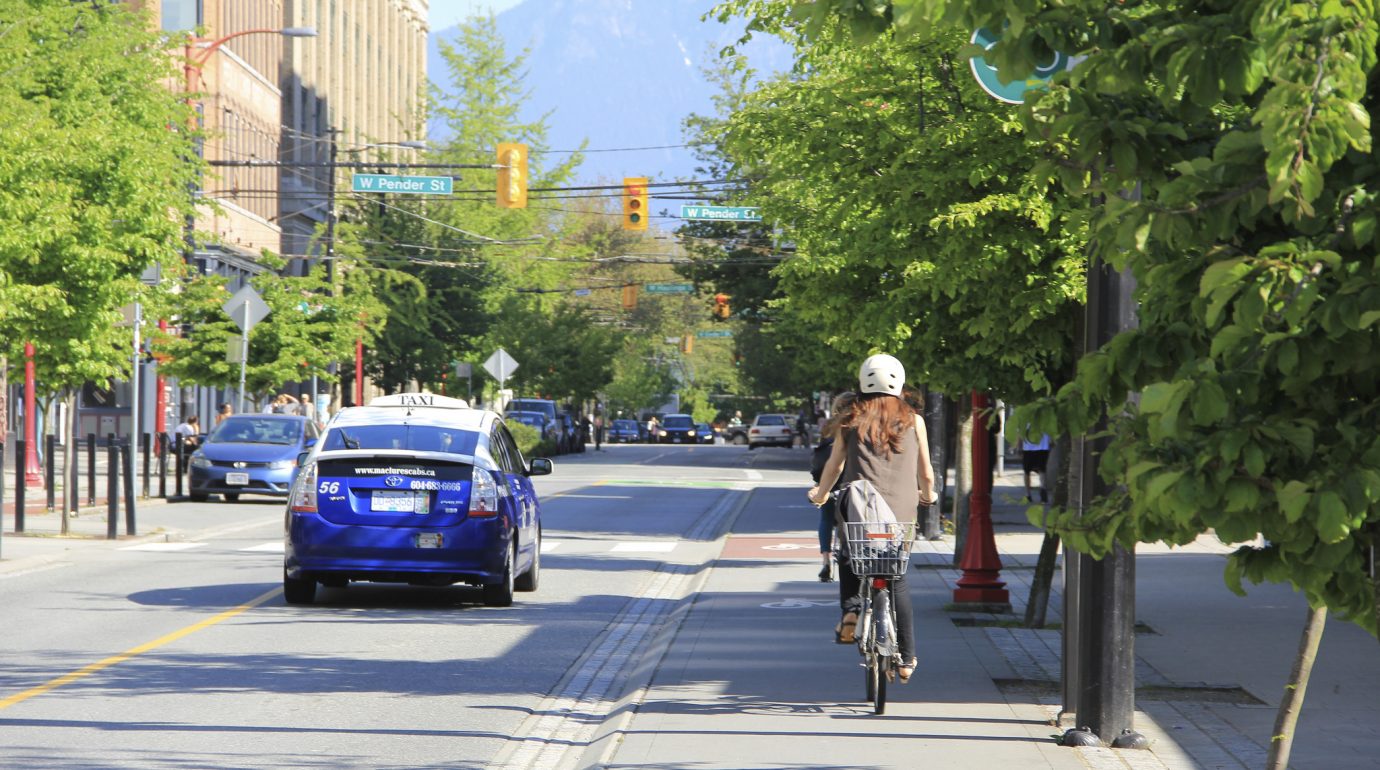
When we think of transformative changes in transportation, we might imagine solid things like trains, more frequent buses, bike lanes, or multi-use trails. But in addition to infrastructure or transportation routes, land use planning and growth management can have a profound impact on how we’re able to get around.

Cycling mode share vs density in Waterloo Region and the Greater Golden Horseshoe.

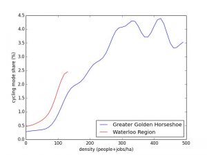
Cycling mode share vs density in Waterloo Region and the Greater Golden Horseshoe. As density increases, the percentage of people who bike increases by an order of magnitude. Data source: 2011 Transportation for Tomorrow Survey, Data Management Group.

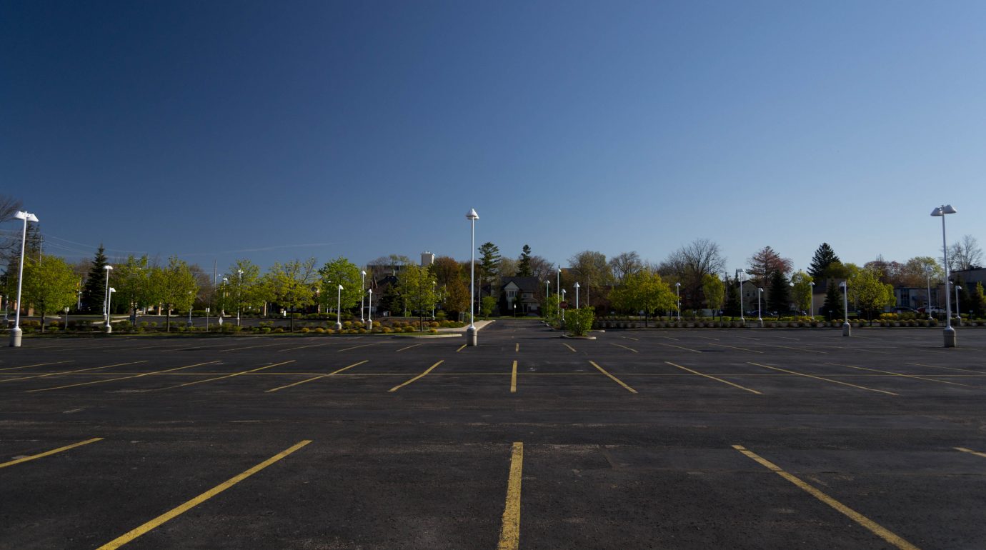
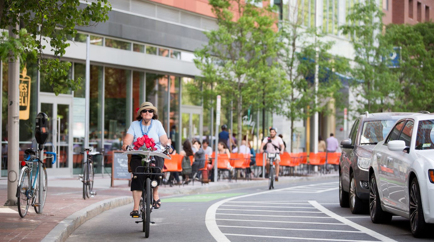
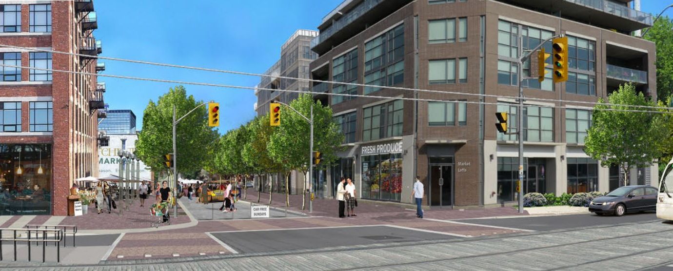
It’s not hard to see why. If the places where you live, work, shop, or go to school are all closer to each other, you’re more likely to choose to walk or bike between them. Likewise, if there are more people coming and going from a particular place, it’s more likely that more frequent transit can be sustained in that area, which in turn makes transit a more attractive choice. If the densest areas in your city or region lie along a line, then transit can become very attractive for trips along that line.

Waterloo Region has led the province in growth management and land use planning – the province relied heavily on the expertise of the Region in developing the Growth Plan for the Greater Golden Horseshoe. We have a higher target than most nearby municipalities for intensification – that is, the rate of development that takes place on previously developed land as opposed to building over farmland or natural areas (‘greenfields’).  In building light rail along the central transit corridor to attract development, we’ve also aligned our transportation planning with our desired land uses. Our Official Plan was challenged by greenfield developers at the Ontario Municipal Board (OMB), which threw our community-supported plans for growth into question for a time.

Last week, the Smart Growth for Our Communities Act was passed in the Ontario legislature, making amendments to the Planning Act and the Development Charges Act. Some of these changes limits the ability for Official Plans to be challenged at the OMB, which will help to protect our municipalities’ ability to guide development in ways that encourage greater walking, cycling, and transit use.

The rules around what municipalities can charge developers for infrastructure to service new construction, called development charges or DCs, are also changing. Previously, the Region could only charge 90% of the cost of new transit infrastructure (e.g. new buses, shelters, facilities, etc.) to developers, now they will be able to charge for the full amount associated with new developments. On top of this, the way in which this amount is calculated is changing from being based on a ten year historical demand average to a ten year forward-looking projection of demand based on planned development. This means that as the Region plans for increased transit ridership, it can charge based on what level of service it plans to provide in the future, not on what it provided in the past. It also means that the Region can apply DC funds towards new services, like extensions of light rail into Cambridge.

Ontario is also conducting a 10 year review of the Growth Plan, and its Advisory Panel led by former Toronto Mayor David Crombie has just released its report of recommendations. While shy on specifics, the report has many recommendations we hope the province adopts because of the positive impact they will have on transportation choice. These include:

  • Investigating and applying increased intensification targets to better support transit and reduce congestion (Recommendations 10, 14)
  • Reduce barriers to intensification and affordable housing, including parking minimums (Recommendation 12)
  • Identify strategic areas with planned or existing transit for intensification (Recommendation 15)
  • Support transit-supportive developments with federal and provincial investments in infrastructure (Recommendation 16)
  • Provide direction to create mixed-use employment nodes that are safe for walking and cycling, and connected with transit (Recommendation 25)
  • Use the goals of the Growth Plan, the Greenbelt Plan, and the Big Move in setting infrastructure investment priorities (Recommendation 59)
  • Improve coordination between the Growth Plan and the Big Move, which could include prioritizing land use planning around Regional Express Rail (Recommendation 60)
  • Clarify and strengthen requirements for Transportation Demand Management in places like GO station areas, urban centres, etc. (Recommendation 62)
  • Reduce barriers to walking and cycling by recognizing these as essential transportation modes and requiring municipalities to plan for them (Recommendation 63)
  • Direct Metrolinx and municipalities to better integrate their transit systems (Recommendation 64)

As Brent Toderian says, the best transportation plan is a great land use plan. Let’s hope Ontario takes these words to heart when guiding our municipalities in how they grow.

Read More »

Photo (c) 2010 James Schwartz on Flickr, licensed under CC-BY-ND.

Signs, signs, everywhere a sign

Regional staff think they can reduce bike crashes with ‘cyclist dismount’ signs. Provincial guidelines say that’s a bad idea.

It’s no surprise that over half of all collisions between bikes and cars take place in crosswalks. It’s partly why our local municipalities have opted to prohibit sidewalk cycling in their bylaws.

Some might argue it’s the victim’s own fault if they’re struck while biking in a crosswalk, as they’re willfully breaking the rules of the road. But when it comes to other issues of public health, such as smoking, substance abuse, or even sedentary lifestyles and poor diets, we don’t allow a person’s choices to prevent us from trying to protect them from unnecessary illness, injury, or death.

Preventing traffic violence should be no different.  In fact, traffic engineers recognize that they can’t just expect drivers to perfectly follow speed limits or obey signs to protect themselves, but have to apply good design and analysis to protect drivers from their own mistakes, (not to mention their passengers or others on the road). This may involve changing the environment so that mistakes are less deadly, or changing the factors which influence people to make those mistakes in the first place.

Each year as part of the Region’s collision report, the top locations for crashes are determined for people driving, walking, and biking, and countermeasures are considered to try to reduce frequently encountered types of collisions. For top collision locations for cars, changes  including conversions to roundabouts, addition of left turn lanes, and dedicated turning phases are considered. For many of the top locations where people walking are struck, better lighting, countdown timers, more visible markings, and crosswalk relocation are all on the table. For King and Cedar, where several people biking with the sharrows have been struck by turning cars, staff are considering restricting certain turns.

Cyclist dismount sign

This sign is used to tell people biking to dismount and walk, which the Ontario Traffic Manual discourages. Photo (C) 2011 Richard Masoner on Flickr, licensed under CC-BY-SA.

But when it comes to people getting hit by cars while biking in crosswalks, it seems the best staff think they can do is put up a bunch of ‘cyclist dismount’ signs.

The province’s bicycle facility guidelines discourage installing ‘dismount’ signs because they aren’t frequently obeyed, and worse, can influence people to ignore other signs and signals:

“The option of asking cyclists to dismount and walk their bikes should not be relied upon in lieu of adequately accommodating cyclists through appropriate road design. Being propelled by muscular power, cyclists more than other vehicle operators will prefer to sustain their momentum and avoid stopping. Cyclists usually find it difficult to rationalize why “dismount and walk” restrictions are in place, and conclude that they were a poor, illogical or arbitrary decision. Thus, if facility designs cause cyclists to make what they consider to be unnecessary stops, this will increase the likelihood that they will ignore or disobey traffic controls, which breeds disrespect for these devices.”

Ontario Traffic Manual Book 18, 1.5 Cycling Myths, page 9

There are several other important reasons why putting up dismount signs aren’t a great idea:

  1. It ignores the real source of the problem. Many of these collision locations are terrible places to bike, leading many to conclude that it’s safer for them to use the sidewalk than the road. Protected bike lanes along these roads, coupled with good intersection design would go a long way towards improving safety.
  2. It implies cycling on the sidewalk is otherwise acceptable.  Putting up signs for cyclists who are on sidewalks would suggest they are expected to be there, which isn’t the case. Even if people biking obeyed the signs and walked their bikes, there would still be conflicts between people walking and biking on sidewalks.
  3. It’s not a viable solution for when sidewalks are changed to multi-use trails. The Region is increasingly looking to using wider multi-use trails in place of sidewalks and bike lanes on busy roads with no driveways. One of the top collision locations, Ottawa at the Laurentian Power Centre entrance, is expected to get multi-use paths sometime around 2020. If we are going to build pathways along roads, we need to design intersections to accommodate people who bike, not effectively ignore them.

Sometimes, paying attention to the actual factors that change behaviour and influence collisions is hard, and putting up signs can make us feel like we’re doing something. Preventing people from being struck by cars in crosswalks requires more than just tsk-tsking them for not dismounting from their bikes, but appropriate infrastructure with good design to accommodate them. We hope to find better solutions in future collision reports.

Headline photo (C) 2010 James Schwartz on Flickr, licensed under CC-BY-ND 2.0.

Read More »

12243107_10153767507602959_2683524994949553066_n

Stage 2 ION light rail public consultations Nov 18-19

Help the Region of Waterloo plan Stage 2 of ION light rail from Kitchener to Cambridge. The Region is conducting a Transit Project Assessment and needs your opinions and input at two upcoming public consultations:

  • Nov 18 – Cambridge City Hall, Bowman Room
  • Nov 19 – Kingsdale Community Centre

For more details, read the consultation handout or visit stage2ION.ca

Stage 2 ION light rail alternative routes

Stage 2 ION light rail alternative routes

Read More »

union-street

Kitchener’s Cycling Master Plan at risk: who owns the street?

Could a vocal opposition  prevent Kitchener’s cycling network from being connected and useful?

Kitchener City Council will be voting on whether to put bike lanes on Union Street (Margaret to Lancaster) on Monday, October 5 at 7pm. While Union has been approved as part of the bicycle priority network in Kitchener’s Cycling Master Plan since 2010, and a tentative design was approved last month at the Community and Infrastructure Services Committee, opposition from some residents threatens to overturn these plans, putting the priority network as a whole at risk.

Last month, in the face of vocal opposition, Kitchener City Council opted to shelve a staff-recommended design for buffered bike lanes on Westheights Drive in favour of a compromise design that preserves parking on both sides of the street. While the compromise design affords some improvement to the experience of cycling on the street and could contribute to safer traffic speeds, the decision has made those who advocate for a useful and safe cycling network concerned about future decisions.

The compromise decision was not made on technical merits, but rather on political considerations. Based on data collected systematically by City staff for on-street parking use, reducing parking to one side of the street would have been more than sufficient for resident needs. But to the residents who protested to Council, this wasn’t enough, so Council sought a solution that would satisfy them.

It may be easy to assume that Westheights was a good example of democracy at work: the people spoke, and Council listened. But scratch the surface a little, and you will find this interpretation problematic.

First, it assumes that the opponents who appeared at Council represent the actual majority view of the residents of the street. This is betrayed by the City’s own survey of Westheights residents which found greater numbers in support to the recommended changes than were opposed. (Dissenters claim to have conducted their own survey that showed the opposite, however it’s important to take this resident-led survey with a grain of salt. Given how some supportive voices were intimidated into silence by belligerent opponents during initial neighbourhood consultations, one can easily imagine many residents nodding along to an angry neighbour on their doorsteps for fear of that hostility being directed towards them. Additionally, given the charged rhetoric used to discredit the buffered bike lane design – the ‘super cycle lanes’ and the exaggerated ‘dangers’ of having to cross the street to park – it’s not surprising this survey solicited a more negative response.)

Second, even if the delegates were truly representative of the residents of the street, giving them final say over a street’s design privatizes the public realm and excludes many other important stakeholders. To be sure, those adjacent to a street are important stakeholders, and should be consulted. But a street does not exist merely for the benefit of the property owners along it, but for the public at large. In the case of Westheights and Union, traffic counts reveal that thousands more residents and visitors from surrounding streets and neighbourhoods use the roadway than just those from properties lining these streets. Unfortunately, the City’s own consultation processes, by engaging predominantly with residents from the street itself, feeds this perception that these collector roads are for their private benefit. It may be challenging, but future consultation efforts should attempt to reach out more to the broader cross-section of a street’s current and potential users to get a more representative view of public desires and needs.

In the case of Union Street, there simply isn’t enough space for a compromise like Westheights to accommodate parking on both sides and still have usable bike lanes. And reducing the parking supply to one side still leaves nearly four times as much parking as there is demand. But like Westheights, we anticipate opposition to this change to be fierce.

Fortunately, you can help to bring safe cycling facilities to Union and ensure that the priority network is not compromised. Probably the two most effective things you can do is show up in the Council chamber Monday night and be visible, and if you’re really keen, register to delegate. If you can’t make it, you can also write to your councillors and remind them that you too are a stakeholder in the form that Union Street will take.

Read More »