Road construction season is around the corner. And with road construction comes bike lane and trail construction too.
We’ve pestered municipal staff, pored over capital budgets, and compiled together a list of all the cycling-related projects starting, continuing, or completing in 2017. In all, we’re counting at least 50 cycling related infrastructure projects underway this year in Waterloo Region. Check out the interactive map, and read the details of projects below.
Legend: bike lane, protected bike lane, off-road multi-use trail, boulevard multi-use trail, crossing/bridge, signed route, sharrows/”shared use”
Cambridge
Conestoga Boulevard, Dunbar to Pinebush, 2.2 km
The city received $325,000 in funding from the province, which is being put towards building a $1 million trail in the hydro corridor along Conestoga Boulevard, as the truck parking on-road cycling lanes are being sacrificed to add turning lanes. The project includes upgrading 6 intersections and bicycle-specific signals.
Sources: CBC KW, TCAT, city staff correspondence
Fountain Street Bridge over the Grand River
The Region is rebuilding the bridge over the Grand River and adding multi-use trails to both sides. When complete, the trails will extend from the Blair Road roundabout to Preston Parkway.
Sources: EA, capital forecast
Fountain Street, Shantz Hill to Hwy 401 and King Street, Fountain to Eagle, 1.4 km
The Region is adding bike lanes Fountain Street from King to the 401, and a multi-use path along Fountain from Shantz Hill to King, and along King to Eagle in lieu of bike lanes, as part of road widening and intersection changes. (Also, a transit queue-jump lane.) Both projects are expected to be completed this year.
Sources: EA, construction notice, capital forecast
Cedar Creek Road, Osborne Street to city limits and St Andrews Street, Grand Ave to city limits, 4.3 km
The Region is adding bike lanes to Cedar Creek and St Andrews, to be completed in 2017 and 2018, respectively.
Sources: EA, construction notice, capital forecast
Franklin Boulevard, 1.2-2.5 km
If you love roundabouts, Franklin Boulevard is the place to go. The Region continues its multi-year roundabout project on Franklin, adding multi-use trails between Champlain Boulevard and Main Street this year. (Utility work is also proceeding for Clyde Road and somewhere between Avenue Road and Robson Ave, but the surface work is not likely until next year.)
Sources: Project phasing, capital forecast
South Boundary Road and Franklin Boulevard extension
The Region is also building a new South Boundary Road for Cambridge, and extending Franklin to meet it. Only a few small pieces are being worked on this year, but when complete, they will add new multi-use pathways to Cambridge as well.
Sources: Project phasing, capital forecast
Grand River Pedestrian Bridge
A pedestrian bridge across the Grand River, between Main and Concession is being built, along with improvements to the East Walkway. While bikes will be expected to move slowly and yield to pedestrians, there will be features, like wheel troughs along staircases to accommodate them.
Sources: City website, city staff correspondence
Melrose Street multi-use trail
A trail is being extended from the end of Melrose Street, giving people walking and cycling access to Lawrence.
Source: City staff correspondence
Linear Trail connection to Westminster Drive S
Access to the Bob McMullin Linear Trail is being opened up from Westminster Drive.
Source: City staff correspondence
Greenway Park multi use trail
New asphalt is being laid for a trail at the south end of Greenway Park to The Greenway.
Source: City staff correspondence
Devil’s Creek Trail extension to Blenheim Drive
Source: City staff correspondence
Franklin Bridge over the 401
We don’t actually think any work on the bridge is actually going to happen until after a contract is awarded in 2018, but it’s in the capital forecast for this year. Essentially, the Region is planning a new multi-use pathway on one side of Franklin across the 401 when MTO replaces the bridge, but the province is making them pay for it.
Sources: Record, CBC KW, capital forecast
Kitchener
Iron Horse Trail, central section (Victoria to Queen)
The city will widen the Iron Horse Trail to at least 3 m, improve some connections with other trails like the Henry Sturm Greenway, replace the bridge, add amenities and signage, and improve the crossing/parking lot at West Ave.
Sources: City website, city staff correspondence
Iron Horse Trail, Glasgow to CN tracks
The Region wants to build a new watermain between its Strange Street and William Street facilities, along part of the Iron Horse Trail. The work, which will proceed in phases, will mean the trail will be disrupted, but the end result will be that its bumpy asphalt surface gets repaved, hopefully to the 3.6 m guideline in the Iron Horse Trail Improvement Strategy.
Sources: EA, The Record
Courtland underpass of Hwy 7/8, 1 km
The city received $325,000 in funding from the province, which is being put towards paving the informal trail along Courtland under the highway. The trail will extend from the golf course to Hanson.
Sources: CBC KW, city staff correspondence
Balzer Greenway Trail
Storm sewer work in the area has allowed the city to build a trail to cross Homer Watson south of Block Line. Some pieces of the trail are already there, (including an underpass of Homer Watson!) but the project would connect up the pieces into a 1.2 km continuous whole. Despite some controversy, Kitchener Council has given the trail the go-ahead.
Sources: EA, CBC KW, Record, city staff correspondence
Upper Canada Park Trail, Pioneer to Homer Watson
As we understand it, there’s some work on the Homer Watson underpass here, so this is more of an improvement to existing infrastructure.
Source: City staff correspondence
Sandrock Greenway
Trail resurfacing is taking place along the Sandrock Greenway (parallel to Westheights). This year’s work focuses on Queen to Hillbrook.
Source: City staff correspondence
Regional Water Main Trail, Bleams to Ottawa
Kitchener is building a new trail behind Activa Ave near the water treatment plant through the hydro corridor.
Source: City staff correspondence
Victoria Park access, Mill to Queen
The trail along Mill St (the Mike Wagner Green) is being extended up Schneider Creek, past the community garden to Queen.
Source: City staff correspondence
Transit Hub Trail, 1.2 km
Initially requested by Kitchener councillors during the approval of the Trails and Multi-use Pathways Master Plan, this would connect the Iron Horse Trail with the future transit hub and King and Victoria, parallel to the rail corridor. Apparently, upper-level government funding is on the table, with a time limit, (like with the Spur Line Trail), so this Region-led project will proceed quickly.
Source: Public notice, city staff correspondence
King Street grade separation, Victoria to Moore
As part of the ION light rail work, multi-use pathways instead of sidewalks are being built along King below the rail bridge near the transit hub. While the mixing of modes in what is expected to be a pedestrian-heavy environment is questionable, it is necessary to separate bikes from the roadway here: at Moore the tracks go from the centre of the street to the outside edges. The risk of a bike catching its tires as it crosses the tracks at a shallow angle, (and on an incline), led to the decision to bring bikes off the road here.
Source: ION light rail functional design plans
Zeller Drive, Wild Meadow to Pebblecreek, 0.9 km
Bike lanes are being added (and in one area, restored) to Zeller Drive. Road widths would not allow bike lanes for the entire stretch without impacting on-street parking, so sharrows will decorate the remainder of the street.
Source: Committee report
Wilson Ave, Kingsdale Community Centre to Traynor, 1 km
The city wants to have cycling facilities along the entire length of Wilson Ave, from Kingsdale Community Centre to Wilson Park. Work south of Traynor will require changes to the number of traffic lanes, prompting an environmental assessment, but limiting on-street parking to one side in the current section is doable this year.
The envelope is narrow, and unfortunately, there won’t be a buffer between bike lanes and parked cars to prevent dooring. The disappearance of bike lanes into sharrows before the Traynor intersection is also concerning, but hopefully this will be addressed in the coming EA.
Franklin Street, which connects in the middle of this year’s section, will be receiving sharrows between Wilson and Kingsdale, as there isn’t room for bike lanes without disrupting on-street parking.
Source: Committee report
David Bergey Dr, Ottawa to Activa, 0.7 km
The Cycling Master Plan has this street marked as “proposed marked shared use,” but apparently city staff are recommending bike lanes here.
Source: Cycling Master Plan update report
Krug Street, Lancaster to River, 1.5 km
This street is part of the Cycling Master Plan’s priority network, as it is one of the few highway crossings that doesn’t have on- or off-ramps. The stretch between East Ave and Becker is being repaved, but staff want to put cycling facilities along the entire length over the next year or two. Last year, staff recommended investigating “creative solutions” to proposed cycling facilities, as there isn’t enough space for both parked cars and bike lanes. (We hope the city’s creativity extends to parking and not just cycling safety.)
Source: Cycling Master Plan update report
Shantz Ln, Weber to end, 250 m
A trail that runs parallel to Highway 7/8 will be extended to Weber along Shantz Ln. The city’s Trails and Multi-use Pathways Master Plan identifies Shantz Ln, Weber, Montgomery, Dixon, and Eckert as a route across Highway 8. (Dixon will receive attention next year.)
Source: Cycling Master Plan update report
Doon Village Road, Homer Watson to Tilt, 1.5 km
Cycling facilities already exist on parts of Doon Village Road, but the road is being rebuilt. Hopefully this work will extend them end-to-end. (Doon Village Road is discontinuous, but a multi-use pathway connects the two sections, making it a continuous route for people walking and biking.)
Source: Cycling Master Plan update report
Rittenhouse Road, Block Line to Erinbrook, 640 m
Rittenhouse Road already has bike lanes, but they’re awful, zig-zagging around (and far too close to) parked cars while leaving dangerously oversized car travel lanes. Hopefully this year’s road work straightens them out.
Source: Cycling Master Plan update report
Sereda Road, Union to Guelph, 650 m
Bike lanes on Union are likely to get extended to Guelph Street this year or the next.
Manitou, Bleams to Homer Watson, 1.5 km
Protected bike lanes are coming to Kitchener! The Region wraps up this project this summer.
Sources: Notice of construction, capital forecast
Fischer Hallman, Ottawa to Bleams, 2.1 km
The Region is rebuilding Fischer Hallman, and will be replacing bike lanes with multi-use pathways.
Sources: Notice of construction, capital forecast
Ottawa Street, McLennan Park to Imperial Drive, and Homer Watson, Ottawa to Hayward, 1.8 km
The intersections of Ottawa with Homer Watson and Alpine are being replaced with roundabouts. As part of the work, multi-use pathways will be built between the park and Imperial Drive, and along Homer Watson to Hayward
Sources: EA, capital forecast
Ottawa Street, Hwy 7 to River, 1.3 km
Ottawa Street is being rebuilt in this section with bike lanes and multi-use pathways, connecting with the paths built last year from River to Lackner.
Sources: EA, capital forecast
Lackner, Fairway to Zeller, 1.1 km
A multi-use pathway is being built along Lackner by the Region. No other details are known at this point.
Source: Capital forecast
Shirley Ave
As part of the new Highway 7 work, the province is relocating Shirley Ave to meet Wellington directly and adding bike lanes. It’s not clear what the future of the River-Shirley pedestrian bridge is.
Source: The Record
Signed routes
The city is implementing some parts of its “priority cycling network” as signed routes. Way-finding, like sharrows or (needlessly ambiguous) “share the road” signs, aren’t really infrastructure, but ideally, they at least serve some purpose in helping to guide people to safer streets. The routes are as follows:
- McGarry at Westheights, to Brookside, Elmwood, Hickory Heights, Forest Hill, Greenbrook, to Stirling
The choice to follow Forest Hill here is questionable, as it leads through two busy intersections with no crossing signals, especially at Fisher-Hallman, which has 5 lanes of traffic. We hope there is some time to consider altering the route to cross Fisher-Hallman at the traffic signals at McGarry, following the path to Uplands Drive. - Oldfield Drive and Shaftsbury, to Holborn
This is the first section of a route that will extend down Holborn to River in future years. - Mill Street, Lansdowne to Borden Pkwy
It’s unclear at this point why this route starts and ends at these locations. Perhaps they’re just the nearest streets, as Lansdowne is half a block away from the Iron Horse Trail, which makes more sense as a starting point. - Margaret, Victoria to Queen
This would guide from the bike lanes north of Victoria to the sharrows on Queen. - Moore, King to Union
As the Region passed up the opportunity to put cycling facilities alongside ION light rail, Moore provides a quiet parallel alternative. The north section ends around the Spur Line Trail in Waterloo, which leads into Uptown. - Cedarwood Cres
In addition to these new way-finding routes, Guelph Street and part of Sims Estate Drive are being designated “shared use.” The Cycling Master Plan has Guelph as a proposed “bicycle priority street.”
Source: Cycling Master Plan update report
In the pipeline: Highway 7/8 crossing?
When GRT made changes to Route 2, they wanted to explore the feasibility of building an active transportation bridge across Highway 7/8 between Chandler and Avalon to restore some transit connectivity to that neighbourhood. Federal funding will go towards a study (no plans to build yet at this point) of such a crossing.
Source: CBC KW, Federal funding announcement
Waterloo
Uptown King Street, tracks to Central, 0.6 km
The city and Region are implementing the first phase of the Uptown redesign, which will put protected bike lanes on King Street, and introduce what appears to be the Region’s first protected intersection at Bridgeport. This is the first of two phases, which will eventually extend all the way to University Ave.
Sources: EA, Active Transportation Program report, capital forecast
Waterloo Park Promenade (Laurel Trail), 1 km
The city is using provincial funding to help rebuild the Laurel Trail through Waterloo Park. People cycling and walking will have separate paths, and controversially, some of the pavement may feature glow-in-the-dark patterns modelled after concepts in physics.
Sources: City website, Active Transportation Program report
Lexington overpass of Hwy 85, 0.7 km
Lexington is the one highway crossing in Waterloo without on- or off-ramps, so it makes a natural highway crossing. The city plans to have cycling facilities along both Columbia and Lexington from end to end, but in the interim, they intend to take the outer westbound lane and turn it into a cycle track/trail across the highway between Lexington Ct and Davenport. What will be critical to the success of this project is how the trail transitions between the bike lanes it meets at Lexington and Davenport.
Sources: City website, Active Transportation Program report
Woolwich Street, 2.5 km
The city is rebuilding Woolwich Street. It will include both bike lanes and a multi-use trail, forming part of the Walter Bean Grand River Trail.
Sources: EA, Active Transportation Program report
Laurel Trail crossings at Weber, Bridgeport
The Region is repaving parts of Weber this year, and the city is having them install a refuge island between the Laurel Trail and Mackay Cres. The city is also trying to persuade the Region to relocate the pedestrian signals at Bridgeport and Peppler to the Laurel Trail.
Sources: Regional construction page, Active Transportation Program report
Columbia Street West, Erbsville to Fischer-Hallman, 1.3 km
We’re not certain if this is happening this year with the change of plans from a new bridge to replacing the culvert, but the city plans to add protected (curb separated) bike lanes to Columbia Street West.
Sources: City website
Erb Street, Caroline to Menno
We have to assume this is contingent on some of the work Grandlinq is doing around Erb and Caroline, but Erb is supposed to be getting bike lanes between Caroline and Menno Street.
Sources: Capital forecast
Bridge Street, Northfield to trail to Wissler, 550 m
Last year, the Region paved a multi-use pathway along Northfield between Bridge and Wissler, which was kind of awkward because it doesn’t connect with much else. The Region is extending the trail now around the corner down Bridge to connect with a narrow path that goes to Eastridge.
Sources: Capital forecast
North Dumfries
New Dundee Road, Fischer-Hallman to Cameron, 2.4 km
Bike lanes are being added here.
Sources: Regional construction page, capital forecast
Trussler Road, Cedar Creek to Hwy 401 and Greenfield to Brant Waterloo Road, 6.4 km
Bike lanes are being added to Trussler Road. This would almost be a continuous stretch, except for the fact that Trussler Road and the highway overpass both bend west, falling outside Regional boundaries. Oh well.
Sources: Regional construction page, capital forecast
Wellesley
Huchison Rd (Crosshill), 0.8 km
Bike lanes and sidewalks are being built in Crosshill. These may also extend along part of West Hastings Line
Sources: Construction notice, capital forecast
Wilmot
Notre Dame Drive and Snyders Road (Petersburg), 1.5 km
Petersburg is getting protected bike lanes (segregated bike lanes and segregated cycle tracks) along its two main, intersecting roads.
Sources: EA, capital forecast
Wilmot-Easthope Road, Hwy 7/8 to Huron St, ~200 m
A tiny bit of repaving at the far western edge of the Region includes bike lanes.
Sources: Regional construction page, capital forecast
Woolwich
King Street, Sawmill to Printery (St Jacobs), 1.9 km
Cycling/buggy lanes are being installed for King Street in St Jacobs.
Sources: Pre-construction info sheet, capital forecast
Sawmill Road and Northfield Drive (Conestogo), 1.7 km
Geometry constraints make some stretches a bit narrow to qualify as bike lanes, but Conestogo is getting bike lanes along its two of its main streets as well.
Sources: EA, capital forecast
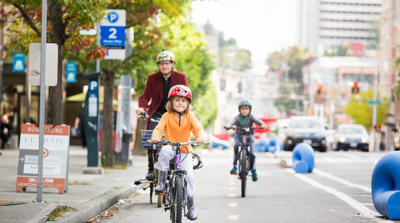
Photo credit: Adam Coppola, Green Lane Project