Category Archives: Light Rail

Screen shot 2014-03-14 at 10.37.30 PM

Stop design and network legibility

Recently, we looked at transit stop design for ION through the lens of branding. Today, we’d like to explore the impact stop design has on way-finding, legibility, and providing information to transit users about when to expect the next bus or tram.

Finding our way

Good way-finding cues will be critical for the integration of ION with iXpress buses and neighbourhood routes. Aside from the stop on Caroline, ION trains will have their own platforms distinct from bus stop platforms. (The aBRT stops however will be accessible by both ION and regular buses.) The Victoria Street multi-modal hub will need to allow connections between ION, iXpress, local routes, taxis, GO and VIA trains, and intercity buses. On top of all this is the fact that north- and south-bound direction stops are split by one or two blocks in both the Kitchener and Waterloo downtowns. Planners will need to be proactive in ensuring that the experience of the Grand River Transit network is a seamless one. (more…)

Read More »

lrt-infographic-web-feature

INFOGRAPHIC: LRT is on the way!

What is LRT? Why is it being built? How will it affect the community? When and where can I ride it?

ION Light Rail Transit (LRT) is the solution Waterloo Region needs to manage our growth, connect our region, and ensure a prosperous future. After a decade of study and public consultation, it’s time to move forward, and time to get excited!

To celebrate ION coming up for its final formal approval and to consolidate some of the answers to frequently-asked questions, we’ve produced an infographic showing why ION Light Rail Transit is the best investment to move us around and shape our region’s future.

Look below the break for the full infographic.

Read More »

Where Will ION LRT Take You Video

VIDEO: Where will ION Light Rail Transit take you?

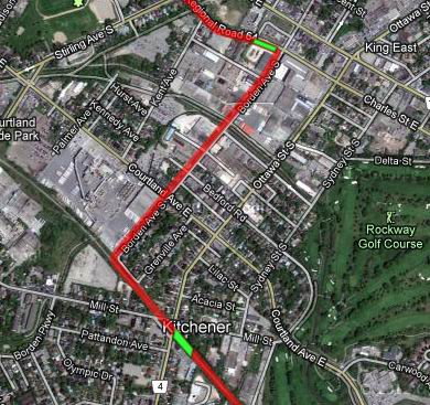
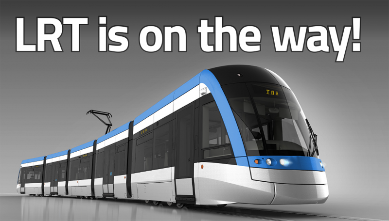
TriTAG supports Light Rail Transit for Waterloo Region because it will be the backbone of our entire transit network, and a vital part of our growth as one of Canada’s largest urban areas. This region is uniquely laid out to allow LRT to serve many destinations along the Central Transit Corridor, while two existing transit nodes will serve as strong anchors for the route. Sadly, there are a few people who still see it as nothing more than “mall to mall”.

But it’s so much more than that. Let’s take a look.

Here are some simple ways you can join us in support of ION light rail in Waterloo region:

LRT fundamentals never stronger

Some pretty amazing numbers are shedding light on the future of light rail in Waterloo region.

This week, regional staff showed how eagerly Grand River Transit’s service improvements have been embraced (link is PDF). With 22 million trips served in 2013, transit use has doubled in just 10 years, and GRT is knocking over ridership targets years early. In Ontario, only two systems (Brampton and York) grew faster, each against a backdrop of exploding population. Waterloo region has grown in size too, but is unique for how strongly transit use has grown per capita.

(more…)

Read More »

What you need to know about 155 Uptown and the Iron Horse Trail

We’ve written before about the 155 Uptown development proposal, which is a 19-storey condo tower plan predicated on the City of Waterloo agreeing to a land swap to move a portion of the Iron Horse Trail. Worryingly, the staff report indicates that the City of Waterloo considers the Iron Horse Trail to be a purely recreational facility. And while there have been a couple of neighbourhood meetings and committee consultation, the general trail-using public has not been consulted about this plan, and most are probably not even aware.

Now is the time to speak up (or send in your written comments), as the proposal is coming up for formal approvals at two meetings on Monday, June 10. Here’s what you need to know:

Planning documents for the development, as well as the staff report and recommendation.

Disposition of the Iron Horse Trail property – formal meeting for the land swap decision on June 10.

Zoning by-law amendment – formal public meeting for development approval, on June 10.

Contact for City Council. Call or email councillors with your thoughts, in addition to providing comments through the formal meetings linked above.

We believe that land in close proximity to LRT stations should indeed be intensified, but with less parking, more active streetscapes, and more sensitivity to the surrounding transportation context than the current 155 Uptown plan. The City of Waterloo should not be making exceptions (and trading off public assets) to facilitate merely “transit-adjacent development”, and instead should focus on making actually transit-oriented development.

Read More »

The Week’s News

It’s Committee week at the Region, which means lots is happening. But first, two other things. Our almost-monthly pub night is tomorrow evening, and you should join us!

Today, the Ontario Coroner’s Office has released its Cycling Deaths Review (HTML / PDF). I have not read through it yet, but it is supposed to claim that all the cycling deaths it looked at were preventable. It also recommends a mandatory helmet law for everyone, which is deeply problematic if the goal is making cycling a safer and larger part of the transportation system. We’ll have more on this later.

Tomorrow is Committee day for the Region of Waterloo. Agendas are always posted here at around 4pm on the preceding Friday. Typically, most issues and reports go to initially to the appropriate Committee, where motions are made, to be finalized at the full Council meeting on Wednesday of the following week. (See Council agendas.) As the standing committees are currently composed of all the councillors, the decisions are effectively made at the committee level, with rare exceptions. (more…)

Read More »

Ottawa/Borden LRT Alignment

Ottawa St, from King St to Mill St in central Kitchener, currently a two lane road flanked by driveways, single family homes, and some industry, is about to get a whole lot busier.

On the books for this 1 km stretch, according to the Region of Waterloo, are plans to:

  • Widen the road from 2 lanes to 4 lanes. (link)
  • Install dedicated biking infrastructure. (link and map)
  • Run the northbound leg of the LRT line. (link)

In total, 1 LRT lane, 4 car lanes, and 2 bike lanes (if not better, segregated biking infrastructure).

That’s an awful lot to fit in the 20 metre right-of-way (pg 7).  Comparing to road layouts planned for other sections of the LRT, it is apparent that this is a large amount to fit in the 30 metres between the front doors of the houses lining this stretch.

It is admirable to intend Ottawa St to serve all of these purposes, and there is no doubt that it is ripe for a rebuild and redesign, but there needs to be a holistic review of what we want to do with the corridor, and what we need to do with it, before we start digging.

If we blindly move forward with current plans for all of the road uses, it is likely that there will be great impact at great cost to the homes on Ottawa. At best, many homes will lose the majority of their lawns, and at worst, an entire side of the street will be expropriated, just as is happening on Weber St. Either way, this would be unnecessarily disruptive to an otherwise stable neighbourhood.

What can be done to mitigate this?  Something needs to move, and that should be the LRT which would be rerouted to Borden Ave.

(more…)

Read More »

LRT Corridor Building Strategy

This weekend was the official launch of the Central Transit Corridor Community Building Strategy (CBS). (The launch was webcast, as other Regional proceedings now are, and should be soon available in the archive.) This Tuesday the 27th, there will be a CBS open house from 3 to 6pm at Knox Presbyterian Church (at Erb & Caroline in Waterloo); there will be a presentation from 5:30 to 6:15 and a workshop from 6:15 to 8:15pm. (Details from here.) We encourage everyone to attend the presentation and workshop.

Though the name of the project is daunting, the idea is both simple and rather important. The Rapid Transit / LRT project is designed to function as a regional transit spine and to attract and handle a large amount of development as urban infill along Waterloo Region’s central corridor instead of as sprawl. The CBS will set out the vision for land-use planning and street networks around stations.

LRT is already attracting development near station areas, but with the zoning currently in place and without a coherent strategy for LRT corridor development, those buildings may not be creating transit-oriented and human-scale places. The “Northfield Station” development is a likely example of a missed opportunity. It isn’t a given that LRT changes its station areas much by itself. For example, outside of Calgary’s downtown, its LRT appears to have primarily influenced the land-use around its stations through the copious provision of parking.

So that the line can create dense, urban, transit-oriented places along the line, the zoning needs to change so that it allows for density, so that it does not require off-street parking, and so it allows and encourages a built form that makes for pedestrian-oriented neighbourhoods. The attraction of a new light rail line is going to result in much development interest of various kinds along the entire line. The CBS should be a guiding mechanism to turn that interest into city-building along the LRT line.

It’s important stuff, and crucial to the Region’s reurbanization and growth management priorities. Attend the Tuesday workshop if you can, and if not, send your comments online or stop by the storefront the project will be opening soon in downtown Kitchener.

Read More »

University Area LRT Station Spacing

One of the main goals of rapid transit is to decentralize the bus network from a system of hub-and-spoke routes to a system of cross-corridor bus routes which connect to rapid transit stations. However, the current planned LRT station locations in Waterloo between Uptown and Northfield are not optimally placed to achieve this goal.

Currently, stations in the University area are planned at Seagram Drive and mid-block between University Avenue and Columbia Street:

Current station locations at Seagram and UW Davis Centre with 600m walking radius

The issue with the above setup is that it would divert cross-corridor routes off their corridors and into a terminal station in front of UW Davis Centre. Diverting trips from these corridors would result in longer cross-town travel times, and would reduce the amount of mixed-use development potential at the cross-corridors. Anyone who has travelled on Routes 7 and 8 through Charles Street Terminal knows the frustrating experience that even a minor route diversion can have on your overall travel time. Time wasted sitting at a terminal is time spent thinking about how much quicker it is to drive or even walk.

As such, TriTAG supports altering the University station locations to the following:

Modified station locations at University Ave and Columbia Street with 600m walking radius

Placing a station at the street provides many benefits over a station mid-block: (more…)

Read More »

LRT Communications Manager Needed

Waterloo Region has a position open for “Manager, Rapid Transit Community Relations” (main job site), and we’re linking it here because effective communication with the public and numerous stakeholders is one of the most important aspects of the LRT project’s success. If you have the necessary background and care about effective transit, growth management, and reurbanization, please consider applying.

Oh, and the perhaps also important position of LRT Project Director is now available (no listing). As is this interesting (and new?) position of “Coordinator, On-Street Passenger Amenities” for Grand River Transit.

Read More »